TOXIC SITES
Superfund History
Comprehensive Environmental Response, Compensation, and Liability Act (CERCLA)
Also Known As -Superfund
- Hinckley, California “Erin Brockovitch”
- Niagara Falls, New York “Love Canal”
- Camp Lejune, North Carolina
- St. Louis, Kentucky “Valley of the Drums”
- Times Beach, Missouri
- Verona, Missouri
- Parkersburg, West Virginia
- Washington Works DuPont Plant, West Virginia
- Michigan “Cattlegate”
- St. Louis, Michigan “Velsicol Chemical Plant”
- North Memphis, Tennessee “Velsicol Chemical Plant”
- Toone, Tennessee “Hardeman County Dump”
- Memphis, Tennessee “North Hollywood Dump”
- Centralia, Pennsylvania “Centralia Coal Fire”
- Libby, Montana “Asbestos”
- Butte, Montana “Berkeley Pit”
- Pitcher, Oklahoma “America’s Worst Environmental Disaster”
- Duluth, Minnesota “US Steel Site”
- St. Louis River Site “US Steel Site”
- Denver, Colorado “Rocky Mountain Arsenal”
- Richland, Washington “Hanford Nuclear Site”
- Church Rock, New Mexico “Uranium Mill Spill”
- Gore, Oklahoma “Sequoyah Fuels Corp”
- Golden, Colorado “Rocky Flats Plant”
- Simi Valley, Santa Susana Field Laboratory
- SL-1 Reactor – Idaho Falls, Idaho
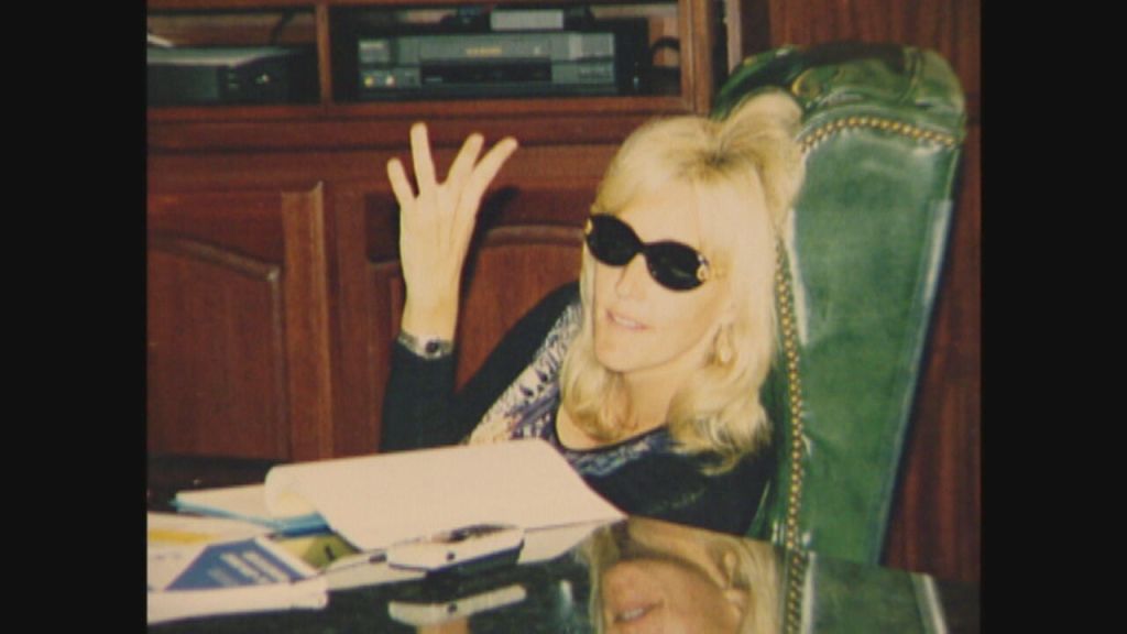
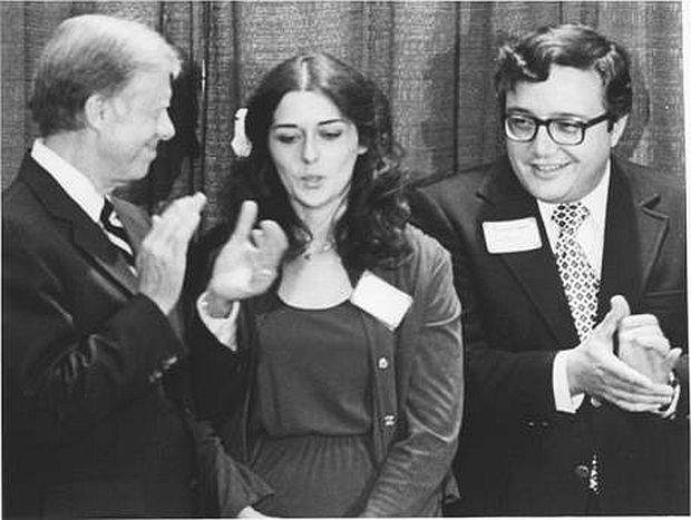
Courtesy of Erin Brockovich via ABC News
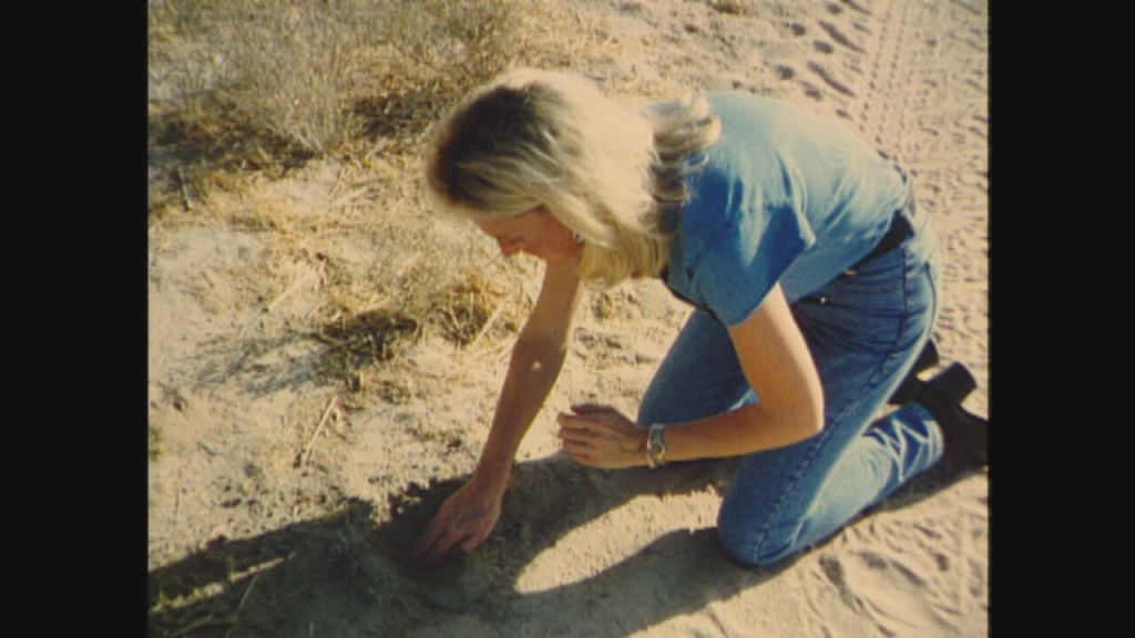
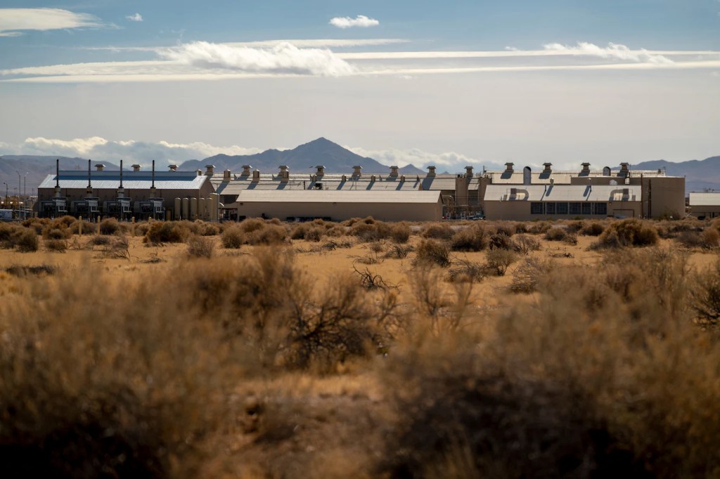
Groundwater Contamination
Hinckley, California
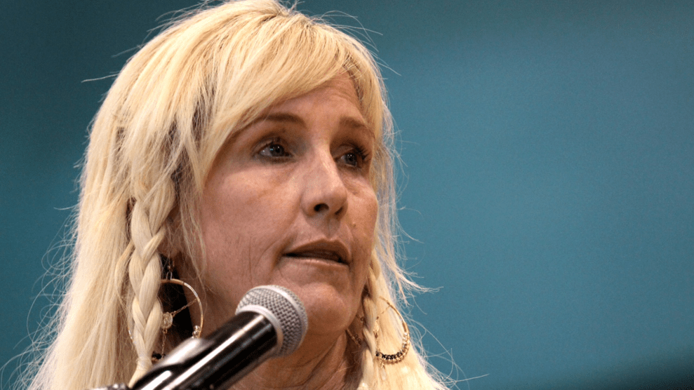
Erin Brokovich
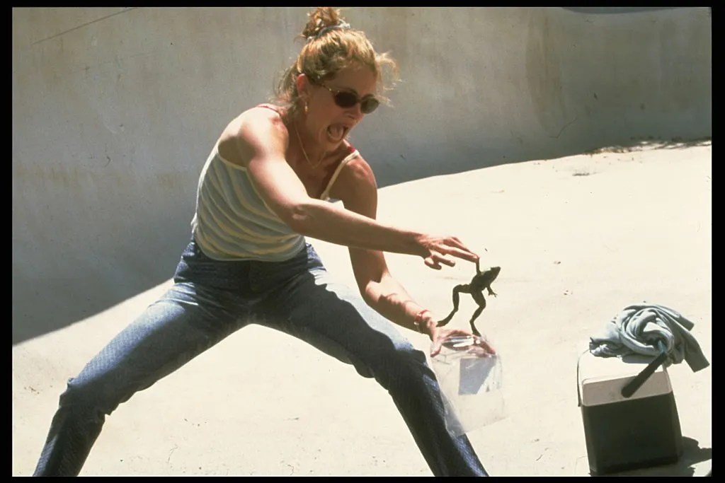
Erin Brockovich, for whom the Oscar-winning movie is named after, came to town from her life as a law clerk and single mother in Los Angeles in 1993, traveling three hours away to the town of Hinckley after hearing of the contamination. When she arrived she quickly found the water was lime green and eventually realized anything that dealt with the water was contaminated and sick; cattle with visible tumors, wildlife was missing, trees dying, the people had common nosebleeds, multiple miscarriages and cancer was common. She then started an investigation into the health effects of the contamination.
“Everywhere I was going in this little community, somebody had asthma, a complaint of a chronic cough, recurring bronchitis, recurring rashes, unusual joint aches, nosebleeds,” Brockovich told “20/20” in a new interview. “It didn’t make sense, and so the more I ask questions … the more I started to piece the puzzle together.”
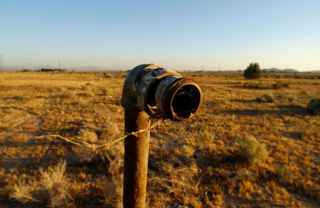
PG&E started adding a toxic form of chromium with water in 1952 to be used as rust preventative at a new pipeline pumping station. It wasn’t until December 7th, 1987 that the company would finally tell the local water board that the company had contaminated the underground water after claiming they discovered the problem on November 1987. The contamination reported violated the states legal limit, 50 parts per billion. It was Roberta Walker who finally had enough, collected documents including reporting in her diary that PG&E testing a monitoring well behind her home had a chromium 6 level of 4,900 ppb; she sent those documents to the law firm of Masry & Vititoe, where Erin Brockovich would take notice when they landed on her desk.
“Hinkley woke me up”, says Brockovich.
“Everyone said the two-headed frog and the green water was normal. I’m like ‘bullshit,’” she shouts in a way that those familiar with the film will recognize.
“Everything was off the charts,” Brockovich, 61, said in an interview. “Every single time one of these environmental disasters happens, its always a pissed-off mom that rises up. Starting with Roberta Walker. Every. Single. Time.”
The Pacific Gas and Electric company (PG&E) was dumping chromium-tainted waste water in unlined ponds, chromium 6 was used as a rust suppressor in the compressors for natural gas transmission lines. Chromium is a heavy metal that is rare in nature, it’s used in a variety of industrial processes, ranging from energy generation to steel making. It’s been labeled as an “emerging contaminant” by the Environmental Protection Agency, which means that the utility companies test for it but there aren’t any legal limits that they’re held to. A later study done by the US Geological Survey, that was ordered by the water board for PG&E to commission, showed that for years the company overestimated the amount of naturally occurring chromium in the ground and also underestimating the plume’s spread.
There was about 370 million gallons of waste water dumped into ponds around the town of Hinckley from 1952 – 1966. It wouldn’t be until December 1987 that PG&E would notify the water board of the contaminated water, that was measuring 10 times the state limit for total chromium.
The National Toxicity Program released a study in 2008 that found that the compound can cause cancer in rats and mice, there was a report on carcinogens in 2014 says “they are known to be human carcinogens.” A human carcinogen means that it’s scientifically proven to increase the risk of developing cancer in humans. The agency that oversees superfund sites, The Agency for Toxic Substances and Disease Registry, has found chromium-6 to be “associated with respiratory and gastrointestinal system cancers.” The EPA, The Department of Health and Human Services (DHHS) and the International Agency for Research on Cancer (IARC) have determined that chromium (VI) compounds are known human carcinogens, it can cause an increased risk of cancer as well as stomach, liver and kidney damage. It was also shown to cause lung cancer when inhaled by humans. Even in small amounts it can cause skin burns, complications during child birth, stomach cancer and pneumonia.
“There should be no carcinogen in water,” Dr. Lynn Goldman, former EPA assistant administrator of toxic substances under President Bill Clinton, told the PBS NewsHour. “The overall problem here is, what does it take for EPA to speed up its standard-setting process?”
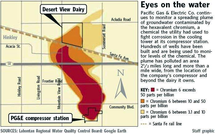
The plume, which is a body of contaminated ground water extending from a source of pollution, of chromium contamination has grown considerably over the years; starting from what was believed to be be 2 miles long and a mile wide plume, in 2008 it was shown to be spreading and in November 2010 PG&E was offering to purchase threatened homes and properties. The local water board reported in 2010 that the poisonous plume of chromium 6 was expanding despite their cleanup order 2 years prior, ordering PG&E to expand its monitoring of the water which just so happened to turn up contaminated areas that previously were assumed to be unaffected. The water board fined PG&E $3.6 million in 2012 for failing to contain the spread of the plume. By 2013 the plume was over 6 miles long, 2 miles wide and slowly growing.
Eventually there was a class action lawsuit against PG&E filed in 1993 which was referred to arbitration with maximum damages up to $400 million for more than 600 people; the first 40 residents were to receive $120 million. PG&E then decided to end arbitration and settle the case for $333 million; it ended up being the largest medical settlement lawsuit ever, now Hinckley is essentially a ghost town, but the effects on the people of this town and their health, can never be undone. In 2006 PG&E settled and agreed to another $295 million to settle cases against another 1,100 people statewide for hexavalent chromium related claims, in 2008 it settled the last of the Hinckley claims for $20 million. PG&E was served with an order to cleanup the effects of the chromium discharge in 2015 by the California Regional Water Quality Control Board, Lahontan Region. At the time of the report the plume was 8 miles long and 2 miles wide. The Lahontan Water Board has PG&E under orders to stop the expansion of the plume and cleanup the chromium plume.
Since the settlement in 1996, PG&E has been working on cleaning the tainted water and containing it, one of the ways they’re doing it is by injecting small amounts of ethanol into the groundwater to turn toxic chromium 6 water into less toxic Chromium-3 water. Chromium-3 happens to be a naturally occurring chemical and essential human nutrient, but we don’t differentiate between the two at the federal level, which needs to be addressed. As part of the mandated cleanup efforts by PG&E, water at 9 of the 44 wells tested were found to have chromium-6 levels more than five times higher than the states maximum, that’s not to mention it was 2,500 times higher than what the state deems safe for public consumption.
PG&E has more recently in 2024 pushed for a higher allowed limit of chromium-6 to be 9 parts per billion, by submitting a letter to the water board. It’s significantly higher than the currently allowed contaminant level, which is the strictest in the country but higher than was found in a 2023 study to be naturally occurring in the area. It’s estimated that to clean up the mess in the town it will take at least 150 years, while everyone in the deals with the side effects.
Chromium-6 has been found in lab tests to exist in the tap water from 31 of 35 American cities which was commissioned by the Environmental Working Group, it was found in concentrations above the safe maximum level that has been proposed by the California regulators. That leaves at least 74 million Americans in 42 states that drink tap water that’s polluted with chromium, the cancer causing hexavalent form is likely in much of that tap water. According to a 2016 analysis of federal data that came from drinking water tests conducted across all 50 states that showed hexavalent chromium contaminates the water supply of more than 200 million people, which is about 2/3rds of the entire population.
Public Health Assessment – 2000
US Dept. of Health and Human Services
Results of Hexavalent Chromium Background Study in Hinkley, California
Hexavalent Chromium Is Carcinogenic to F344/N Rats and B6C3F1 Mice after Chronic Oral Exposure
PUBLIC HEALTH GOALS FOR CHEMICALS IN DRINKING WATER -HEXAVALENT CHROMIUM
Hinckley Groundwater Remediation Program
Courtesy Mother Jones
Courtesy of Erin Brockovich
via ABC News

Courtesy of USGS
(David McNew/Getty Images) Courtesy LAist
Love Canal, Niagara Falls, New York
Before the State and Federal government got involved with the site, children would play in the material seeping up from the ground, completely unaware of the hazardous and dangerous fluid they were playing in. The EPA had announced results of blood tests in 1979 that showed high white blood cell counts, a pre-cursor to leukemia and also that 33% of the Love canal population had undergone chromosomal damage which looks worse when the average population experiences chromosome damage that only affects 1% of the population.
The Niagara Falls Board of Education purchased the canal in 1953 for a dollar but writes into the property deed a disclaimer with a limited liability clause of responsibility for future damages, in lieu of threat of eminent domain. The school board builds a school and sells land to be developed into residences, 23 years later in 1976 the Niagara Gazette reports stuff from the landfill is seeping into basements, a chemical analysis finds presence of 15 organic chemicals including 3 toxic chlorinated hydrocarbons that were all being moved through sewer city storm system and improperly discharged into the Niagara River.
The school was completed in 1955 and 400 children would start the school year in a new school, the schools architect wrote to the education committee stating workers found two dump sites with 55 US gallon drums containing chemical waste and noted it would be poor policy to build in the area without knowing what wastes were present and the concrete foundation might be damaged, that same year a 25 foot area crumbled and left toxic chemical drums exposed that filled with water during rainstorms and the kids would play in the puddles. The playground had to be moved because it was located directly on top of a chemical dump with the school construction being moved 80-85 feet to the north.
It was 1957 when the city of Niagara Falls thought it was a good idea while constructing sewers for new low income and single family homes to be built, to punch through the protective clay walls; the local government also had the bright idea to remove part of the protective clay cap to use it as fill dirt on the nearby 93rd street school. Between the school board knowing they paid a dollar for a property and that unknown chemicals may or may not be buried on the property, then built housing and schools for the families to be living all around a toxic waste dump and nobody thought twice? Was everybody involved in these decisions sharing the same 3 brain cells?
Courtesy Pop History Dig
There were 700 more families who had tests from the NYS Department of Health showing the toxic materials seeping into their homes, the federal government claimed they were at insufficient risk to warrant relocation; after another hard fought fight and protests from the activists Jimmy Carter declared a second state of emergency to relocate the reimagining 700 families, it probably led the federal government to quicker action when angry residents detained two representatives from the EPA as a form of protest to garner action and attention. President Carter signed a second state of emergency in 1981 after another hard fought battle by activists, the relocation costs for all families would be $17 million, even though the EPA had originally disagreed with the State of NY’s request to declare a broader emergency declaration area and the pace of relocation, stating the relocation was too hasty and the area was not as contaminated as the state claimed, the federal government has a history of denying events that it doesn’t want to acknowledge or pay for so who’s really surprised?
There were 2 more sites used for chemical waste dumping by Hooker Chemical, Hooker (S-area) was an 8 acre site which held 63,000 tons of chemical waste products and is located adjacent to the Niagara Falls drinking water treatment plant, as well as Hooker (102nd street) landfill which was 22 acres and used to dump 21,000 tons of mixed organic and/or inorganic compounds, solvents and phosphates, and related chemicals to include hexachlorocyclohexans which was used in a now banned pesticide, Mirex. Two of the other big selling chemicals were benzene hexachloride and trichlorophenol; lindane is a close relative of benzene hexachloride and are among the chemicals most commonly linked to Leukemia, lindane was eventually shown to accumulate in the brain and liver tissue and also damage the nervous system. Hooker would voluntarily withdraw its government registration for benzene hexachloride after lab tests in the mid 1970’s showed lab rats fed the chemical developed tumors and reproductive effects.
Courtesy of Levin Center
Camp Lejeune Water Contamination
Jacksonville, North Carolina
Camp Lejeune Timeline
History of the Contamination
Camp Lejeune, is a 156,000-acre (about 233 square miles) Marine Corps military base in North Carolina, home of the “Expeditionary Forces in Readiness,” had three contaminated water systems from 1953-1987 and is considered one of the worst toxic sites in the United States. Those sources were exposing over a million people to toxic chemicals that cause cancer, leukemia, birth defects and other serious health conditions. The three estimated contaminated drinking systems on base were Hadnot Point, Tarawa Terrace, and Holcomb Boulevard; the contaminates were from both off-site and on-site sources but most were sources on-site of the base. The contaminants ranged from pesticides such as chlordane and DDT, heavy metals like arsenic and lead, benzene as well as the solvents trichloroethylene, perchloroethylene (PCE), tests also found, Tetrachloroethylene (TCE), methylene chloride, vinyl chloride and toluene. Not to mention two different sites that contained radioactive material. There were so many babies that were born at Camp Lejeune that died in the 1960’s and 70’s that at a cemetery nearby there was a section that parents called “Baby Heaven”.
In 1963 the Navy’s Bureau of Medicine and Surgery issued detailed drinking water rules, banning any chemicals from being present in the water on military bases in concentrations that would jeopardize human health. Camp Lejeune officials were meant to enforce these rules at the base. The issues didn’t stop at mass contamination of water either, there also seems to have been some lack of care especially when they located a daycare in a former malaria control shop where pesticides were mixed and stored. That doesn’t even come to the level of a contractor getting ready to grade a parking lot and ends up digging up the radioactive bodies of dead beagles and laboratory waste labeled “radioactive poison”, strontium-90. This area was the former site of the Naval Research Laboratory dump and its associated incinerator. That wasn’t the only dumpsite for radioactive waste on the base though, retired Marine master sergeant Jerry Ensminger who spent 24 years serving this nation, he found a Navy document in 2007 that was from 1981 and indicated there was a dump site near a rifle range for radioactive waste that included two animal carcasses laced with strontium-90, it’s an isotope that causes cancer and leukemia. He also found other documents such as one that referred to “radiation pools”, there was also a 1984 water-testing report that showed radioactivity levels more than twice the allowed amount. Jerry sadly lost his 9 year old daughter in 1985 to leukemia, he later went on to found an advocacy group called The Few, The Proud, The Forgotten; they press the ATSDR, the Marine Corps and other government agencies to take action on the behalf of those affected by the contamination.
The residents of the base weren’t notified of the potential water contamination until a base newsletter in June 1984 stating the military was going to initiate a study on contaminants in the water, the announcement in the newsletter downplayed the exposure and the military didn’t even expect anyone to be exposed. The residents were then notified in December 1984 that their drinking water was contaminated with “traces” of contaminates, a few months later in April 1985 residents were notified there were 10 wells had been closed as a precautionary measure because “traces amounts” of contaminates in the water. This issue was only reported locally and those who had already left the base and the area weren’t notified, with most not learning of the issue until Dan Rather reported it in 1997- a decade after the last wells were shut down.
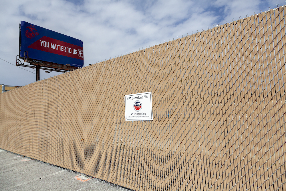
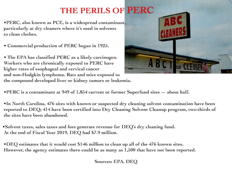
A family owned dry cleaning company, ABC One-Hour Cleaners, was a source of contamination whose building was located about two miles southeast of Camp Lejeune. They were illegally dumping a dry-cleaning solvent tetrachloroethylene (PCE) that was used as part of their operations, into the septic tank system which discharged to a drainage field on the property and also burying it improperly outside of the dry cleaning building. That’s not to mention the powder residue from solvent tanks, called “still bottoms” and also known as muck, would be used to fill potholes in the parking lot, about a ton over 30 years; a dry cleaner down the road paid for their still bottoms to be hauled to the county landfill. That chemical would contaminate two wells supplying water to one of the family housing communities on base, Tarawa Terrace.
After the EPA was created in 1970 waste disposal became more tightly regulated, the soil from under the building was tested showing PERC concentrations as high as 2,100 parts per million (ppm) while the groundwater at the cleaners was showing 12,000 parts per billion (ppb)- thousands of times higher than state regulations allow, groundwater is subject to stricter standards than soil, and it was located only 500 feet from Tarawa Terrace. The Agency for Toxic Substances and Disease Registry (ATSDR) conducted water modeling for the Tarawa Terrace and based on the model results, the PCE concentration was estimated to have exceeded the current EPA maximum contaminant level in the drinking water at the treatment plant for 346 months from November 1957 – February 1989 (almost 29 years).
The site was sold in 2005, changed names to A-1 cleaners and turned into a drop-off only location, they then shut down completely in 2011 and the buildings were demolished with the foundations being the only thing remaining. According to EPA documents the plume has grown to 1,500 ft long, 400 foot wide and as much as 250 feet deep in some places.
There was a feasibility study conducted by the EPA in 1992 and they selected the cleanup method in 1994; being implemented from 2000 – 2007 and involving a combination of a pump-and-treat method with monitored soil vapor extraction and natural attenuation (the reduction of the force, effect, or value of something). The contamination by 2009 had only been reduced by approximately 15%, in 2014 the EPA determined that that the only way to remediate the groundwater is they would have to address the soil contamination, they did so by removing the septic tank in 2019 and the soil cleanup was completed in 2020. The cleanup isn’t over unfortunately, it’s still going on according to the EPA, the area is surrounded by chain link fencing and under heavy restrictions. The original owners, now deceased, denied wrongdoing according to North Carolina Policy Watch.
There were multiple sources of contaminated water at some of the wells at Hadnot Point from on-site contamination including on-base spills at industrial sites, leaks from underground storage sites, leaks from drums at dumps and storage lots, an open storage pit, a former fire training area, an on-base dry cleaner, a liquid disposal site and a fuel tank sludge area. The Hadnot Point system’s primary contaminant was trichloroethylene (TCE), but there was also other chemicals found in the water to include benzene, methylene chloride, vinyl chloride and toluene.
Those weren’t the only things found in the water though, there were also metals that have been detected. The water treatment plant at Hadnot Point began operations in 1943 but there’s no estimates of when the contamination began. Hadnot Point had also supplied water to Holcomb Boulevard system from 1942-1971, which led it to be found to be intermittently contaminated. An Army laboratory chief who worked for the U.S. Army Environmental Hygiene Agency noted in 1980 that some chemicals were showing up in the water tests; “Water is highly contaminated with low molecular weight halogenated hydrocarbons.”. The lab chief, William Neal Jr., noted that the water at Hadnot Point was highly contaminated with halogenated hydrocarbons, which are chemical compounds that can include a variety of industrial organic compounds.
The base hired a contractor in 1982 to conduct similar tests looking for trihalomethanes (byproducts of chlorine), but he couldn’t accurately test for that because the water was too full of organic solvents, he was finding the halogenated hydrocarbons that was noted two years prior. Contractor, Mike Hargett, alarmed the base officials about the contamination but because there weren’t any defined standards for wastewater, little action followed; Hargett continued to speak out about the issue through 1983. Assistant Chief of Staff of Facilities got ahold of the state of North Carolina and notified them in May of 1988 there was a 15-foot thick plume contaminating the groundwater under the fuel facility. There weren’t any attempts to remediate it until 1989 even though a staff judge advocate had noted there was a loss of fuel at the rate of 1,500 gallons per month into the ground and observed the ongoing threat to human health.
There was also an industrial area at Hadnot Point that contained a fuel farm which had 14 underground tanks and a 600,000 gallon above-ground tank within 1,200 feet from a major drinking water well, HP-602. This information was revealed during the 111th Congress in September 2010 House hearing, it was also revealed that the Marine Corps knew about the contamination for more than 4 years before shutting down the drinking water wells at Camp Lejeune. There was a fuel leak in 1979, the first documented leak at the fuel farm when an estimated 20,000-30,000 gallons of fuel leaked from an underground valve. For years there was an estimated 1,500 gallons each month that leaked out of the fuel farm and the Marine Corps did nothing to stop it. A year later an engineer determined that the tanks were old and poorly maintained, with the storage tanks and connecting pipelines were corroded and deteriorating. The third contractor had a meeting in 1996, the minutes showed they estimated there was a loss of 800,000 gallons of fuel from the farm of which 500,000 gallons that was recovered.
The fuel leak itself in 1979 was never remediated, the deteriorating underground storage tanks were determined by the military that repairing the tanks would not be cost-effective and were not replaced until 1990, with a strange coincidence that the state of North Carolina has a statue of repose prohibiting lawsuits after 10 years, shocker. One of the wells tested so high for benzene it measured at 380 ppb, with the EPA having an established maximum contaminant level goal of zero parts per billion. A third contractor had “dramatically underreported” the level of benzene in the tap water on base, which was found by the Associated Press in 2012. The ATSDR found a contractor in 1984 has erroneously documented the benzene level in one well at 38 ppb, the final report by the same contractor in 1994 conveniently the benzene level altogether.
There were local requirements in 1979 that led the military to begin testing the water for trihalomethanes, a volatile organic chemical (VOC) that stems from water chlorination, the military tried to get an exemption from testing citing a lack of resources, it was denied. In October 1981 the military took samples and there were other VOC’s than the one they were testing for, there was tetrachloroethylene (PCE)- a dry-cleaning solvent, trichloroethylene (TCE)- a solvent used in metal degreasers, and benzene- a fuel component. TCE wasn’t regulated until 1989 and benzene wasn’t regulated until 1992 under the Safe Water Drinking Act, even though the health risk were known. The military ignored multiple warnings issues from the labs about the safety of the water.
Both the United States military and a privately owned dry cleaner were contributing to (or hid) the contaminated ground water. The water was impacted by the original base dump, leaks from underground drum dumps, leaks from underground storage tanks, transformer storage lot, open storage pits, the dry cleaner dumping waste, liquid disposal area, an industrial fly-ash dump, fuel tank sludge area, former fire training area and a burn dump.
When the testing of 40 wells started in 1984 by the military, there were 10 wells found contaminated with high levels of PCE and TCE, with all wells at Hadnot Point having traces of benzene. Those wells were removed from the rotation from November 1984 to February 1985 and Tarawa Terrae was closed permanently in 1987. The site wasn’t added to the EPA’s National Priorities List until October 4th, 1989, they found several contaminates of concern (COC) in the soil, sediment, groundwater, surface water of the base including but not limited to Dichloroethane, Tetrachloroethane, Trichloroethane, Arsenic, Barium, Bezene, Acetone, Vinyl Chloride, Chromium, Copper, Cyanide, Lead, Gasoline and Diesel. There was a Federal Facility Agreement (FFA) entered into by the Navy, the North Carolina Department of Environmental Quality (DEQ) and the EPA in February 1991 for site cleanup activities. The contamination is so widespread across the base that there’s currently 40 Operable Units that are being investigated and remediated.
There was a study conducted by the Centers for Disease Control and Prevention that was published in the journal Environmental Health, it compared 150,000 Marines stationed at Camp Lejeune from 1975 – 1985 with 150,000 Marines stationed at Camp Pendleton in California during the same time. The results were that those who lived or worked at the base when the water was actively contaminated are more likely to die from Lou Gehrig’s disease or certain cancers. Camp Lejeune Marines were found to have the following increased risks; roughly 10% greater chance of dying from cancer, 35% higher risk of kidney cancer, 42% higher risk of liver cancer, 47% higher risk of Hodgkin’s Lymphoma and double the risk of ALS if exposed to vinyl chloride.
The cleanup process has included the Navy removing contaminated soil, above-ground and underground storage tanks, batteries, drums and other toxic waste materials from 1992-2001. Then from 2001-2009 the Navy had removed an estimated 48,000 pounds of Volatile Organic Compounds (VOC’s) from the soil while they studied cleanup technologies, they added groundwater monitoring, used oxidants to break apart contaminants and included institutional controls. In 2009 the ATSDR removed the original 1997 Camp Lejeune Public Health Assessment have found that “that communities serviced by the Holcomb Boulevard distribution system were exposed to contaminated water for a longer period than we knew in 1997. Also, at the Camp Lejeune site, benzene was present in one drinking-water supply well that was not listed in the 1997 PHA. The PHA should have stated there were not enough data to rule out earlier exposures to benzene. We are currently studying that well to determine if it was used as a drinking water source while it was contaminated.”
The Navy inspector general produced an investigative report in 2013 obtained through a Freedom of Information Act request revealing “shortfalls in the oversight and management of drinking water for Navy personnel stationed overseas—even in wealthy, developed countries.” The report concludes that “not a single Navy overseas drinking water system meets U.S. compliance standards” or the Navy’s own governing standards,” according to POGO.
ATSDR Timeline
Agency for Toxic Substances
and Disease Registry
The Few, The Proud, The Forgotten
Clendening v. United States, No. 20-1878 (4th Cir. 2021)
Promises to Address Comprehensive Toxins
(PACT) Act
Janey Ensminger Act
Resources
Camp Lejeune Justice Act Claims
The Camp Lejeune Families Act of 2012 provided cost-free health care to veterans and their families who lived in the area exposed to the contaminated water with qualifying conditions such as;
- Esophageal cancer
- Breast cancer
- Kidney cancer
- Multiple myeloma
- Renal toxicity
- Female infertility
- Scleroderma
- Non-Hodgkin’s lymphoma
- Lung cancer
- Bladder cancer
- Leukemia
- Myelodysplastic syndromes
- Hepatic steatosis
- Miscarriage
- Neurobehavioral effects / Parkinson’s disease

Courtesy The Brockovich Report
Courtesy Kreindler LLP
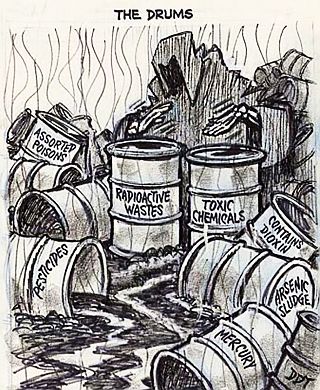
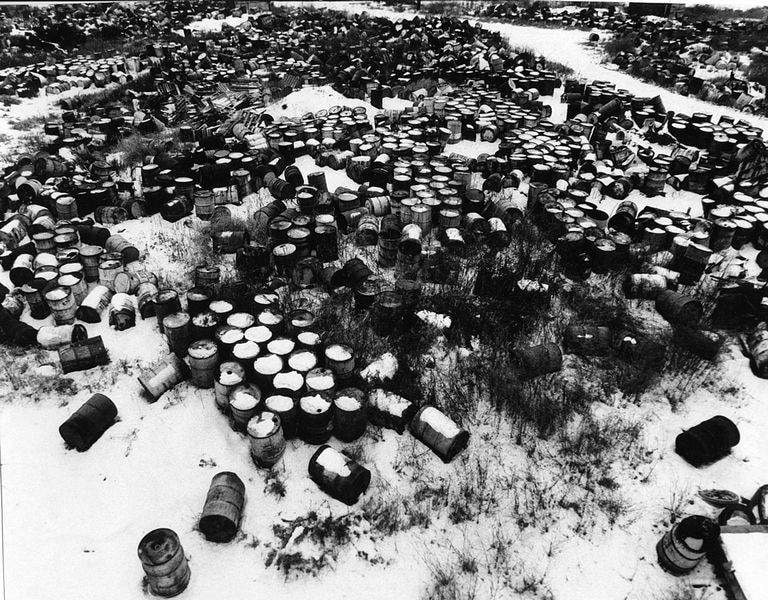
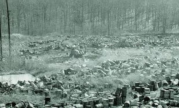
St. Louis, Kentucky
Valley of the Drums
Courtesy Pop History Dig
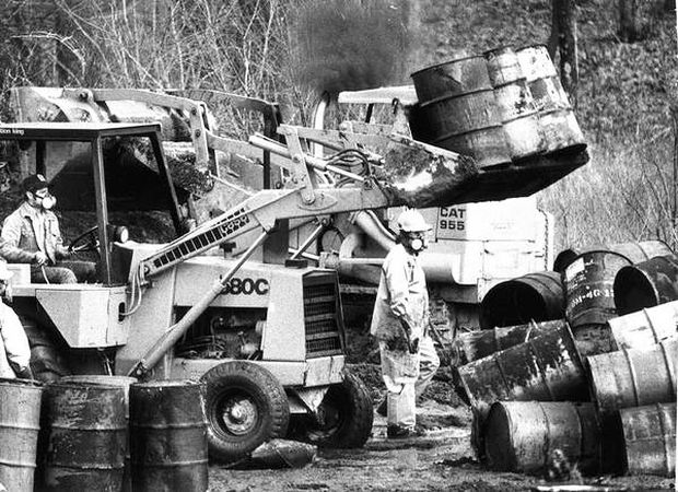
It was only in November 1966 when the industrial waste dump in Northern Kentucky caught fire that it was noticed, burning for a week and being visible in Louisville 15 miles away once the smoke drifted over the city is when people started to pay attention to what was going on. 23 acres, filled with barrels of various materials and open pits of discarded drums and waste. A.L. Taylor had some land and started a “drum cleaning” business and waste disposal business which really just meant dumping whatever comes through into open pits, a portion of which was paint but some of the barrels and drums found were from major companies such as DuPont, Monsanto, Ford Motor Co, Celanese Polymer Specialties Co, Ashland Chemical Co, Chevron Oil Co, Union Carbide and others.
Starting in 1967 and for the next decade A.L. Taylor was dumping waste in open pits and leaving other barrels to collect dust around his property, accumulating and/or processing tens of thousands of drums containing various degrees of paints, solvents and harmful chemicals. Since he never got the proper permits to run the type of business he was running, he was flying under the radar even with Kentucky environmental agency tried to bring legal action against him but the issue continued.
The EPA showed up in 1979 in response to a “surface water pollution emergency”, joining state regulators in removing 10,000 barrels of hazardous waste from the site and they weren’t the friendly kind you can jump on like in Donkey Kong Country. They didn’t do anything about other barrels and waste in a nearby forested hollow that became to be known as “gully of the drums”, 700 feet away from the landfill even though the court ordered the cleanup.
Courtesy Levin Center
Courtesy of Pop History Dig
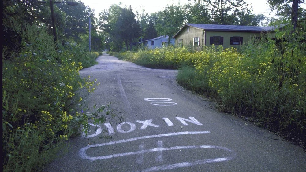
Evacuation of Times Beach, Missouri
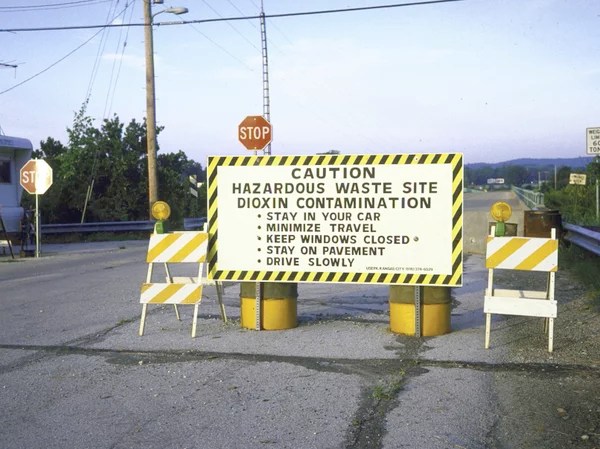
Bill Pierce/Time & Life Pictures/Getty Images
Courtesy of NPR
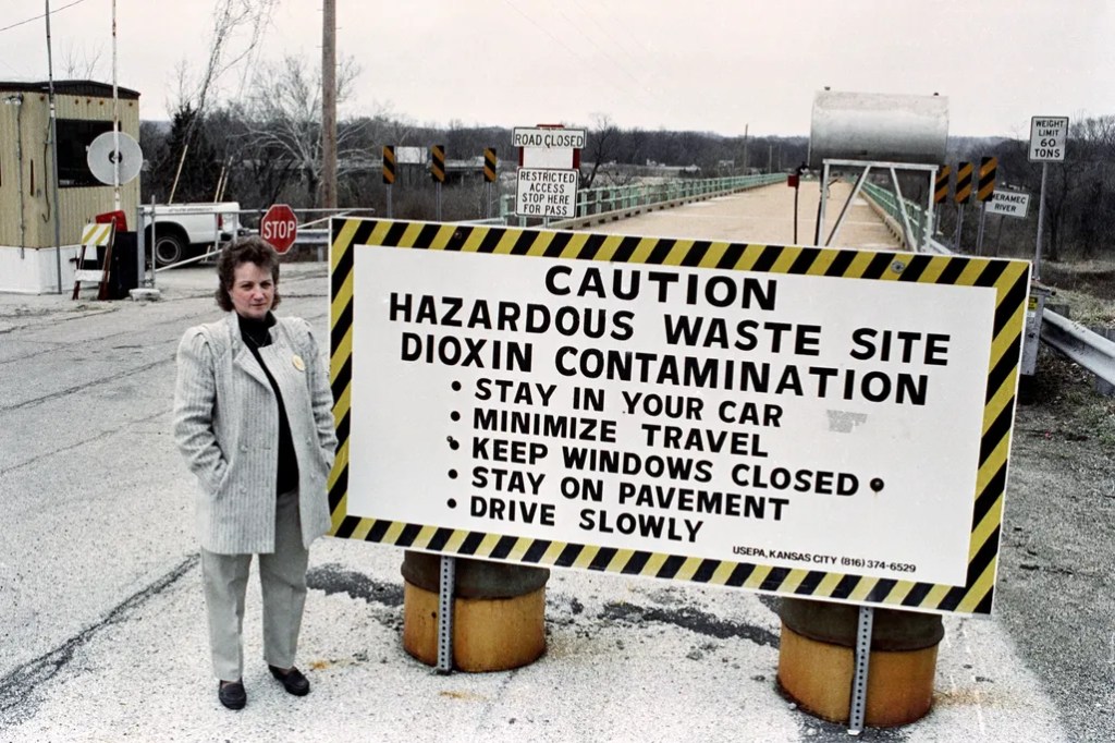
From 1971 – 1976 the town of Times Beach in Missouri was spraying oil on the dirt roads to keep dust down because they couldn’t afford to pave them, the spray was a mix of oil and chemical waste from production of a chemical for Agent Orange dioxin and hexachlorophene. Dioxin was added to the oil sprayed on the dirt roads and horse tracks around Missouri and it was the byproduct of the production of 2,4,5-trichlorophenoxyacetic acid by the chemical company Hoffman-Taff for Agent Orange and also the production of hexachlorophene by Northeastern Pharmaceutical & Chemical Company (NEPACCO) located in Verona, Missouri.
Courtesy of NPR
The site that first got the attention of the Missouri Department of Health and the Center for Disease Control in 1971 was at Shenandoah stables where over 40 horses died; birds, cats and dogs were also found dead near the arena, but when the stable owners 6 year old daughter became terribly ill it was when the investigation began. They eventually were able to track down the source to oil hauler Russell Bliss who sold the mix to towns, church’s and horse forms as a dust suppressant, he sprayed the oil mix around the area in the early 1970’s; it was sprayed in 25 locations around the state including the town of Times Beach, dirt roads, horse tracks and arenas.
The kids once had fun sliding in the purple tinted goo, but years later animals dropping dead and kids getting sick would change the perception of a veterinarian in the area. The CDC mobilized the resources in 1974 to investigate the contamination and where Bliss both stored and sprayed the oil dioxin mix. The EPA began testing in 1979 of the soil and in 1982 the agency announced that the levels of dioxin-the newspaper said is “the most potent cancer causing agent made by man” – were off the charts.
There was about to be a major flood in December 1982, a 500 year flood, the flood stage was 18.5 feet but the water crested around 43 feet; the Army Corps of Engineers had warned people the flood was coming and some stayed despite the warning. A few days after the city reopened it received the results of the soil test, the people of the town couldn’t afford to have the results quantified so they got a yes or no answer on PCB’s and Dioxin; the PCB levels were low but the dioxin was a problem. The EPA had a limit when this event happened of 1 parts per billion of dioxin and anything over would be hazardous, the town measured more than 100 parts per billion. Those who had returned were told to leave and the people who hadn’t come back yet were warned not to come back to town.
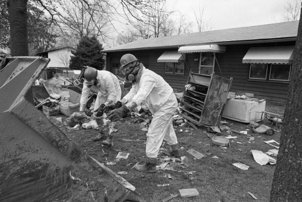
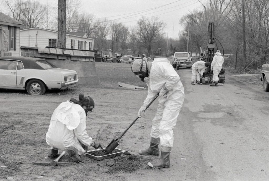
Photo Credit: Bettmann / Getty Images
The 2,500 residents were torn on whether to stay and rebuild or ask for an EPA superfund buyout, 50 of the 801 families in Times Beach wanted to stay and argued dioxin wasn’t a threat. The acting mayor then sent a petition to President Ronald Reagan for a request to have the EPA buyout property owners, in February 1983 the administrator of the EPA, Anne Gorsuch Burford, came to do just that, announce the buyout of the property owners at fair market value to the tune of a $20 million and another $15 million to build a concrete bunker to store the contaminated soil from 6 other sites would be stored. It was on April 2nd, 1985 that the towns former residents voted it out of corporate existence and only one elderly couple lived there at the time.

In 1990 the consent decree was entered and the EPA became responsible for excavation and transporting dioxin-contaminated soil from eastern Missouri sites to Times Beach for incineration, the state is responsible for long-term of the Times Beach site. The settling defendants were responsible for demolition and disposal of the structures and debris after the permanent relocation, the construction of a ring levee to protect an incinerator sub site from floods, the construction of a temporary incinerator, excavating the contaminated soils at Times Beach, operating the incinerator, and then the restoration of Times Beach upon the completion of the response actions.
The incinerator would end up treating a total of 265,354 tons of dioxin-contaminated materials from 27 eastern Missouri dioxin sites, including 37,234 tons from Times Beach after being brought to the site in 1996, with the EPA spending $250 million. The remains were then buried in a “town mound” and the cleanup was completed in 1997. It would be officially opened as a state park on the site of the 409 acre Route 66 Park, named after the historic road that runs through it, on the site of the former Times Beach in 1999 and in 2001 it was removed from the National Priorities List as it was no longer posing a threat to the public health or environment.
“Walking around the streets, walking into the houses, many of them were like people had just simply stood up, walked out and never came back. Plates on the tables, Christmas trees, Christmas decorations outside, and just street after street of that,” said Gary Pendergrass, a Syntex Corporation engineer hired to help clean-up Times Beach, as told to Jon Hamilton.
“This is one more example of the success of the Superfund program. Thanks to Superfund, Times Beach and the 27 nearby areas sprayed with dioxin-laden waste oil are clean and back in use,” said Lois Schiffer, former assistant attorney general in charge of the Justice Department’s Environment and Natural Resources Division. “Without the enforcement provisions of the Superfund law, we would never have been able to make those responsible for the awful contamination that occurred in and around Times Beach pay to clean it up.”
Courtesy of Smithsonian Magazine
James Denny Farm;
Verona, Missouri
The same company, Northeastern Pharmaceutical & Chemical Company (NEPACCO), whose chemicals were used in waste oil mixed dust-suppressant that was sprayed on roads and horse arenas across Missouri to include Times Beach; were found to have disposed of 80-90 drums of still bottoms and refinery waste in a shallow trench, which was roughly 10 feet wide and 60 feet long, on the farmland of James Denney beginning in 1971. A lawsuit was brought by the EPA in 1980 against NEPACCO, two of its former officers and an ex-employee; alleging a former shift supervisor, Ronald Mills, had a waste disposal agreement with NEPACCO and that supervisor paid a plant worker named James Denney to bury about 90 barrels of dioxin contaminated waste on his farmland, being paid $150 for use of his farm to dispose of the . The EPA wasn’t involved with the dioxin sites in Missouri until a former NEPACCO employee reported the toxic waste stored on a farm 7 miles from Verona, Misssouri.
The EPA wanted the defendant’s to pay for the other cleanup costs, as well as reimburse the EPA $500,000 it spent for the investigation and pinpointing the dioxin contamination at the Denney farm. EPA officials believe this was the first time a recovery suit brought under the 1980 Superfund hazardous waste cleanup had gone to trial as previously the EPA got reimbursed in negotiated settlements. The judge, Judge Clark, ruled that the EPA was only entitled for reimbursed for expenses after the clean up fund became effective in December 10th, 1980.
The company who leased the facility and equipment to NEPACCO, Syntax, was named in the suit and they made a consent agreement without admitting any guilt, agreed to clean up the site and reimburse the EPA up to $100,000 for the agency’s costs. Between October 1985 and June 1989 the EPA operated a mobile incineration system and treated almost 6 million kilograms of dioxin-contaminated wastes from 8 area sites. Let’s not forget that there were 37 dioxin toxic waste sites in Missouri alone.
Earl Tennant Farm,
Parkersburg, West Virginia
Wilbur “Earl” Tennant was a farmer in the 1990’s who was seeing his cows losing weight regardless of how much he fed them, developing tumors and dying; he contacted the West Virginia Division of Natural Resources and the West Virginia Department of Environmental Protection but felt like they were stonewalling him, the state Veterinarian wouldn’t even come out to the property. He realized he needed help so he turned to lawyers in Parkersburg to sue DuPont and they turned him down as DuPont was one of the biggest employers in the area, neighbors helped remind him of a fellow neighbors grandson who was now an environmental lawyer in Cincinnati, so he reached out and got the help he was looking for; Rob Bilott, the environmental lawyer grandson of one of his neighbor.
The Tennants had sold some of their land to DuPont years earlier to be used as a landfill for office waste as DuPont told one of the brothers in person and also in writing, now the landfill that DuPont used was contaminating the creek that meandered past the landfill then spilled into his pasture, there was a drain pipe from the landfill into the creek on Earl’s farm. That same creek where Earls cows drank from, was covered in a foam recorded on a VHS videotape using a camcorder, the video starting with emaciated cows with tumors on their hides then showing the froth covered creek before cutting to a dissected calf with blacked teeth and oddly colored organs.
This would be a 20 year battle against DuPont by Rob Bilott, it would lead to the revelation that DuPont was dumping a chemical called C8 in to the Ohio river and the air around its plant and just what DuPont knew about what was going on. C8 or PFOA, has a related class of PFAS which is used in things like pizza boxes, flame-retardant foam sprays and Teflon; was dumped in to the river even though the company knew for decades that C8 was toxic and feared it was poisoning workers yet still continued to dump it with complete disregard for where it may go and who it may affect, they never told the EPA or the community about what they knew.
Earl Tennant would eventually agree to settle out of court with DuPont for an undisclosed amount of money.
When Ron Billot filed a suit in federal court, it was during litigation that it was revealed DuPont purchased PFOA from 3M to make Teflon, documents discovered confirmed DuPont knew about the potential health problems for decades and did nothing.
-In 1962, a rat study found “‘cumulative liver, kidney, and pancreatic changes’” in young rats dosed with PFOA.
-In 1965, a study on beagles exposed to PFOA showed toxic liver damage.
-In 1978, DuPont tested PFOA on monkeys. Monkeys given the highest dose died within a month, and even those given the lowest doses showed signs of toxicity.
-In 1978, after testing workers’ blood, 3M and DuPont decided not to disclose under the Toxic Substances Control Act (TSCA) the presence of fluorine found in the workers’ blood.
-In 1979, DuPont was aware that PFOA was biopersistent, and in 1980, DuPont had documentation showing they knew that PFOA bioaccumulated in the body.
-In 1981, a 3M study on rats showed PFOA caused birth defects, specifically to the eyes, in unborn rats. Unlike before, 3M disclosed the study to EPA. DuPont, studying their workers, noticed that two of seven babies born recently had been born with eye defects. DuPont did not continue the study. Another rat study failed to show the same defects and 3M went back to EPA and relayed that the previous study was invalid.
-In 1983, documents demonstrated that DuPont was aware of a viable, potentially less toxic, alternative, TBSA, as well as methods for reusing PFOA; however, these were more expensive and DuPont chose to proceed with the status quo.
-In 1988, a two-year cancer study on rats linked testicular tumors to PFOA.
-In 1988, DuPont scientists set a Community Exposure Guideline for DuPont workers with safe limits for PFOA at 0.6 ppb, around the lowest they could detect at the time.
-Also in 1988, DuPont decided to move thousands of tons of PFOA contaminated sludge to an unlined landfill, the landfill upstream of the Tennant’s farm.[2] Shortly after, DuPont measured the PFOA leaching from the unlined landfill into the creek at levels as high as 1600 ppb. DuPont did not warn the Tennants or the public.
-In 1993, another rat study linked PFOA to testicular, pancreatic, and liver tumors.
-In 1999, another monkey study showed monkeys with low doses of PFOA dying within a few months or suffering so much that the researchers “sacrificed” them.
(2)Robert Bilott, Exposure 81 (2019). DuPont was able to dump the PFOA sludge as nonhazardous waste because PFOA was not regulated under TSCA. PFOA and PFOS were grandfathered into the Act and companies only had to report if a chemical presents “a ‘substantial risk of injury to health or the environment.’” Id. at 94. DuPont did not self-report.
Throughout this period and for decades more, DuPont maintained that PFOA demonstrated no known human health effects.
STEEP
Sources, Transport, Exposure
and Effects of PFAS
Kentucky tests public drinking water systems, half of systems tested show evidence of PFAS contamination.
C8 Health Project
Mid-Ohio River Valley
DuPont experimented on “volunteer” employees by having them smoke cigarettes laced with Teflon
C8 Science Panel
According to a report by the CDC, 97% of all Americans were found to have PFAS in their blood
Forever Chemicals (PFAS) show up in your clothes, food and home
The Devil they Knew: Chemical Documents Analysis of Industry Influence on PFAS Science
PFAS is present in 98% of all Americans
Forever chemicals are everywhere
Perfluoroalkylated compounds in the eggs and feathers of resident and migratory seabirds from the Antarctic Peninsula
Alarming levels of PFAS in Norwegian Arctic ice pose new risk to wildlife
DuPont study confirmed PFOA is toxic in animals – 1961
List of nearly 800 hazardous substances subject to regulation
What EPA has learned about PFAS
-PFAS are widely used, long lasting chemicals, components of which break down very slowly over time.
-Because of their widespread use and their persistence in the environment, many PFAS are found in the blood of people and animals all over the world and are present at low levels in a variety of food products and in the environment.
-PFAS are found in water, air, fish, and soil at locations across the nation and the globe.
-Scientific studies have shown that exposure to some PFAS in the environment may be linked to harmful health effects in humans and animals.
-There are thousands of PFAS chemicals, and they are found in many different consumer, commercial, and industrial products. This makes it challenging to study and assess the potential human health and environmental risks.

DuPont Washington Works Plant
West Virginia
In the 1980’s the DuPont company thought it would be a an easy way to dispose of some waste and decided to dump 7,100 tons of PFOA-laced sludge into open unlined pits, which just so happened to then seep into the ground and get into the local water table that was used to supply drinking water to the 100,000 people in the towns of Lubeck, Vienna, Little Hocking and Parkersburg.
In the 1990’s and 2000’s the DuPont company decided to voluntarily test the water around certain company facilities in West Virginia, they ended up finding varying concentrations in and around certain DuPont facilities but also in private drinking wells and public water supplies.
The Chemours’ Washington Works plant still discharges high levels of PFAS, including banned PFOA and the new yet still toxic GenX, despite a 2023 federal order meant to curb pollution.
Stoneridge Farm PFAS Contamination
Arundel Maine

“Cattlegate”, Michigan

There was a huge problem that came to the herds of Michigan’s cattle farmers in the early 1970s, workers at the Michigan Chemical Company, owned by Velsicol Chemical Corporation, provided feed bags that would get sent to feed mills around the state, the issue is they had inadvertently switched the bags from those containing magnesium oxide, a common cattle feed supplement with other poorly marked bags of a known flame retardant containing polybrominated biphenyls (PBBs) as the main ingredient. The bags were then shipped to feed mills for use around the state of Michigan in the feed supply for cattle and other livestock, unknowingly leaving farmers to poison their animals, all because there was a shortage of pre-labeled paper bags and a communication oversight in the plant sending out the feed bags to the Michigan Farm Bureau Services building. It wasn’t just the bags that were contaminated, the machines used to mix the feed were also contaminated and kept spreading the toxic chemicals into the feed for months. By the spring of 1974 PBB’s were found in the food chain through widespread farm product consumption of pork, lamb, chicken, beef, milk, chicken and eggs. Michigan Chemical and the Farm Bureau had put together a $15 million insurance pool to help farmers that lost their herds and the herds production but the damage wasn’t done.
Photography by Mark Brush, Michigan Radio
Courtesy Emory University
The first person to do an investigation in 1973 to the sick cows was 31 year old dairy farmer Frederic “Rich” Halbert who happened to hold a master’s degree in chemical engineering and also used to work for Dow chemical company, after veterinarians couldn’t find out the problem and with the sick cows not eating much and the milk production dropping from 13,000 lbs to 7,600 lbs a day, he thought it might be the feed. His vet, Dr. Ted Jackson, would end up being a major ally in the fight, he had noticed some other symptoms in the cattle, they had runny eyes and stopped chewing their cud (portion of food regurgitated in order to digest a second time), the udders on cows who recently gave birth were shrinking, So he fed a group of calves feed from half a dozen different sources and he was able to figure out the source of the problem was a product purchased from Farm Bureau Services Inc., earlier that year. Frederic ended up spending $5,000 of his own money on lab tests and long distance phone calls to find out the feed had been contaminated with PBB’s after his herd was quarantined he ended up having to destroy 800 of his cows in 1974.
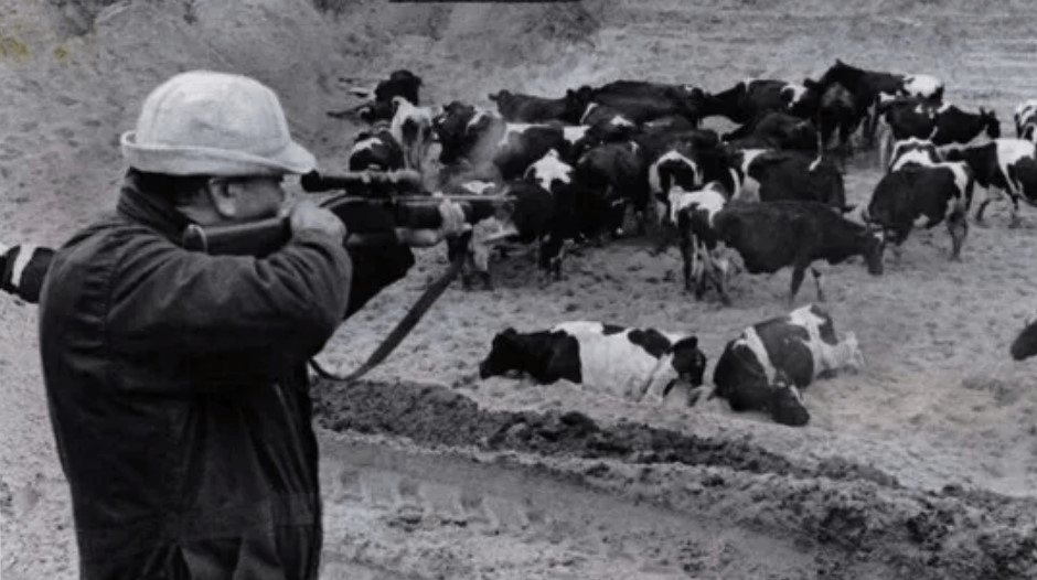
It was on April 19, 1974 that Rich got an answer from the Wisconsin Alumni Research Center, a low-resolution test on a mass spectrometer, the mystery chemical was a form of bromine. By the time it was discovered what was causing a state wide cattle illness nearly all living Michiganders, 9 million people, had consumed the chemical through meat or milk, which was later found to be linked to high levels of exposure to breast and liver cancer, as well as kidney and thyroid problems. There were tens of thousands of animals began dying, giving birth to young with gross deformities, losing their ability to walk straight and shaking uncontrollably.
Emory University has done PBB studies with the Rollins School of Public Health to understand the effects on humans, Michele Marcus, has been studying the effects PBB contamination for the last 15 years. As a Rollins environmental epidemiologist, she knows that even now, 40 years after the accident 80-85% of Michiganders have elevated PBB levels in their blood, if that wasn’t bad enough animal studies have shown it can have affects several generations later. The state of Michigan Department Community of Health transferred the PBB registry to Rollins where Marcus heads up the research.
“We know from animal studies that some of these hormone disrupting chemicals can affect up to four and five generations down the line,” says Marcus. “But it’s one thing to be a scientist and study these statistics. It’s quite another to have a mother approach you and tell you her daughter entered puberty at age five.”
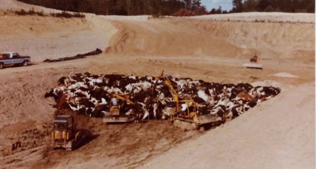
In total there were 32,000 cows, more than 6,000 swine, 1,370 sheep, 1.5 million chickens and 4.5 million eggs destroyed as a result of the contaminated feed, as well as considerable quantities of eggs, cheese, butter and dried milk over a two year period. There would be over 500 farms that would be quarantined across the state of Michigan due to PBB exposure and contamination. Since the contamination was discovered in 1974, both the Farm Bureau Services and the Michigan Chemical Company have settled 500 claims with farmers to the tune of $30 million, with some 300 other claims still pending. Farmers have maintained that state officials tried to coverup the scandal, with agriculture department officials contending that farmers were exaggerating the extent of PBB contamination and blamed it on poor livestock management by the farmers.
Serum Polybrominated Biphenyls (PBBs) and Polychlorinated Biphenyls (PCBs) and Thyroid Function among Michigan Adults Several Decades after the 1973–1974 PBB Contamination of Livestock Feed
Courtesy Birdge Michigan
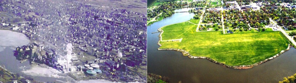
Velsicol Chemical Plant
St, Louis, Michigan
Courtesy Tennessee Lookout
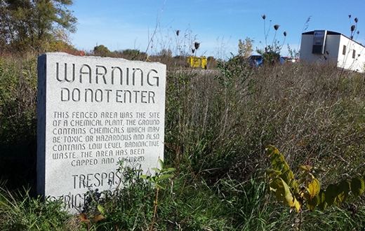
Velsicol Chemical Company, formerly Michigan Chemical Corporation, had a 54 acre main-plant site in St. Louis where they produced various chemical compounds from the 1930’s until it closed in 1978, to include the now banned pesticide DDT, cattle feed supplements, chlordane which was banned in 1988 because of its cancer risk and the flame retardant polybrominated biphenol (PBB). After contamination at the former plant site was discovered the building was simply knocked down and buried with hundreds of chemicals in 1982 in an agreement with the EPA and the state of Michigan, then there’s the significant contamination of Pine Creek that borders the former site on three sides. The EPA, Velsicol and the state of Michigan entered a consent agreement in 1982 where Velsicol agreed to construct a slurry wall around the former site and put a clay cap over it. In this time the town had to shut off their wells and switch to a new water supply, all thanks to this wonderful company.
There was an initial clean-up effort by Velsicol in the early 1980’s, originally thought to be good enough, the reality would be starkly different than the company hoped for, it was discovered later that the remediation efforts had failed when high levels of pesticide were found in fish tissue and river sediment, leading the state to issue a no consumption advisory for any fish species. The DDT levels in the fish have been reduced by over 98% which is a great start but the state plans to keep the fish advisory until the entire site has been cleaned up.
Velsicol filed for bankruptcy in 1999 and the EPA took control of the site and the remediation of not only the main plant site but also the Pine Creek and the Burn Pit area. The actions taken at the site from 1998 – 2006, addressed contamination in the Pine River at a cost of $100 million, during that same time period the EPA funded a sediment cleanup in the Pine River adjacent to the site, with part of the cleanup including removing over 670,000 cubic-yards of DDT contaminated sediment and disposed of it in an approved landfill. With studies in the early 2000’s showing the slurry wall and clay cap at the main plant site were not keeping contamination out of the river, the EPA and the Michigan Department of Environmental Quality launched a remedial investigation and feasibility study at the main plant site, the result was the soil and the groundwater were contaminated.
Later in June 2006 a selected remediation project would include a comprehensive cleanup of the main plant site and a residential soil cleanup. The residential soil cleanup would see the EPA move 50,000 tons of contaminated soil to an off-site landfill. In October 2022 the EPA started a new cleanup phase that’s going to excavate 100,000 tons of contaminated soil from the southern part of the old site and trucked to an off-site landfill.
Air is still contaminated 40 years after the Michigan Chemical plant disaster in St. Louis, Michigan
Former Burn Area
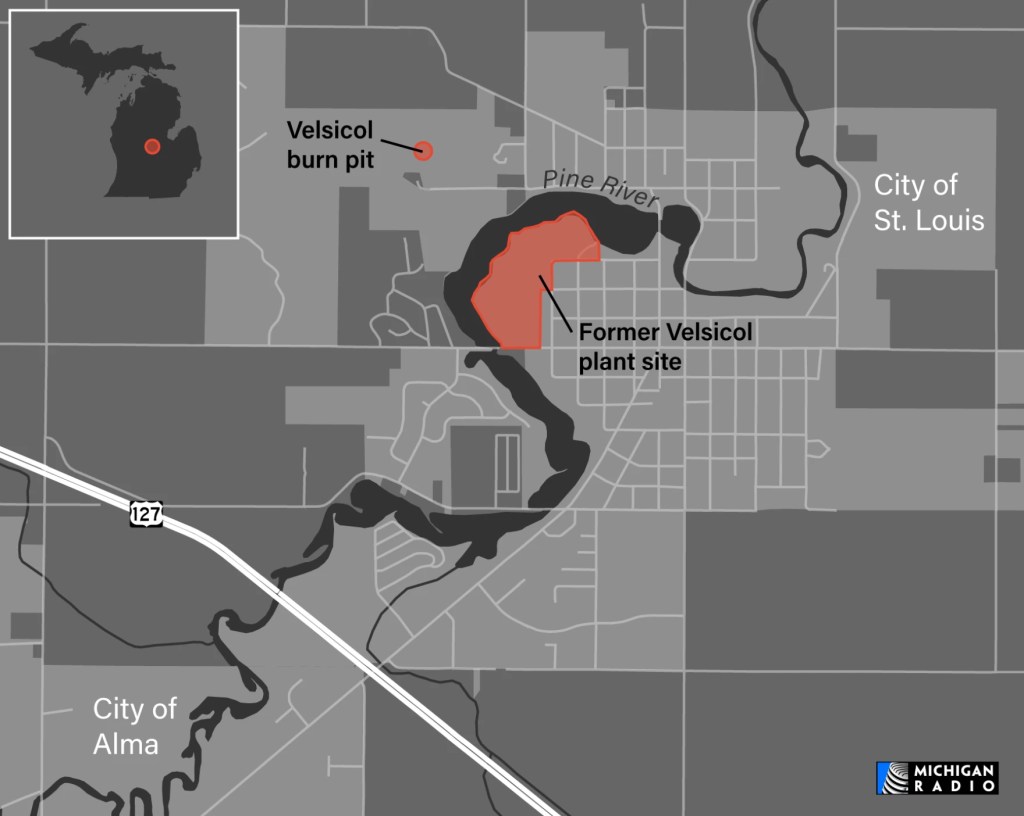
Velsicol Burn Pit, Michigan
The 5 acre site is a former burn area where Velsicol Chemical Plant, formerly Michigan Chemical Corporation, used to burn their toxic industrial waste products and pesticides from 1956 – 1970, which is now located in an out-of-bounds area in the Hidden Oaks gulf course (there’s more than oaks hidden here), the pesticides and chemicals used to maintain golf course greens likely doesn’t make the old burn pit any safer or better for the environment and the people wandering around it.
The industrial waste and pesticides that were burned here were then found to have contaminated surface soil and groundwater, according to the EPA there are 25 hazardous chemicals buried on the small parcel, including DDT, benzene, mercury, magnesium and lead. Approximately 2,000-3,000 gallons of hazardous material was dumped in the burn area, the site was first proposed in 1982 to be added to the National Priorities List by the EPA until Velsicol removed 68,000 cubic yards of contaminated soil and because of that action the proposal to add the site to the NPL was cancelled.
More soil and groundwater contamination was discovered in 2006, the EPA and the state of Michigan re-proposed the addition of the site to the NPL, in March 2010 the site was added to the NPL which made federal funding and analysis. There are also 150,000 gallons of something called a non-aqueous phase liquid, or DNAPL, on the property, the EPA plan was to use an in-place thermal treatment system to clean out the 1.4 acres of soil contamination. As of 2024 the EPA had begun startup procedures for the in-place thermal treatment system, the entire remediation is expected to take 2 years and cost $30 million.
Courtesy of Michigan Public NPR
Velsicol Plant,
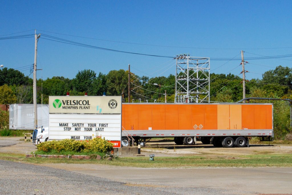
North Memphis, Tennessee
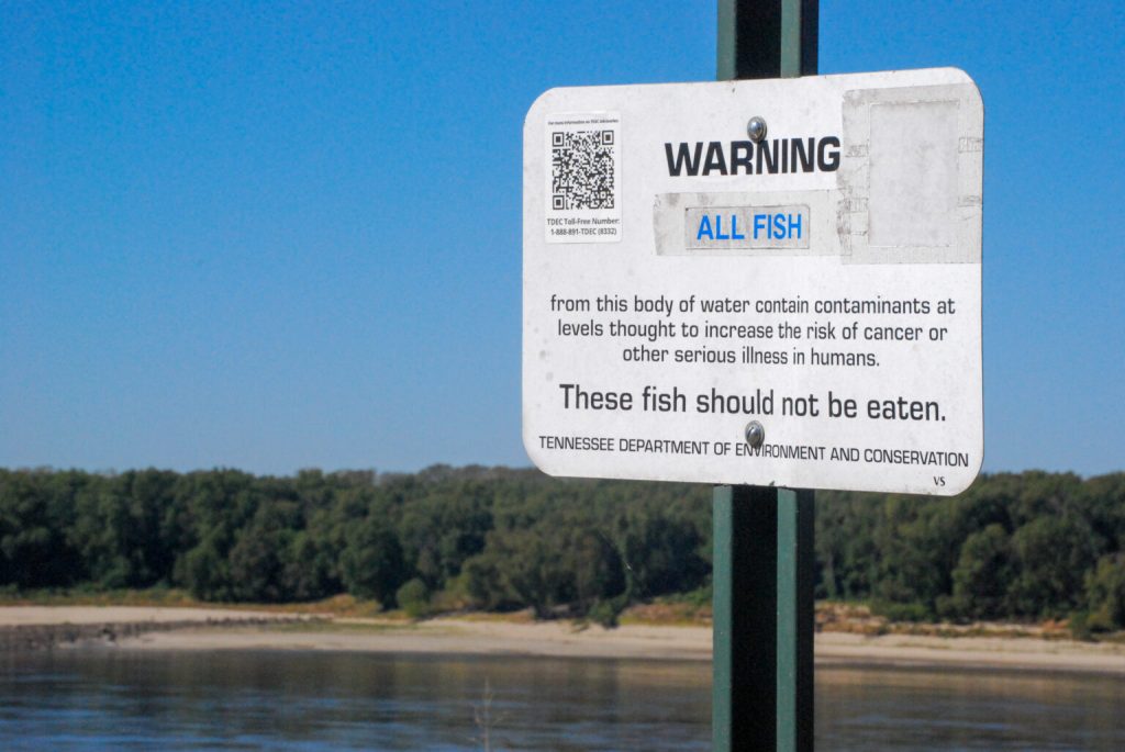
Velsicol who is a legacy polluter, proposed to give the state of Tennessee its 83 acre North Memphis site as an environmental response trust, manufactured chemicals for pesticides so powerful a spray could kill a flying insect before it hit the ground, they were also a large producer of products like chlordane, a man-made substance which was banned by the EPA in 1988 due to its cancer risk. The Wolf River still carries the legacy of the North Memphis plant lives in the depths of the river and the shallow layers above the Memphis Sands Aquifer where sediment contains hazardous industrial chemicals that do not dissolve in water. The fish in Wolf River absorb the chlordane as they swim through the water contaminated with the chemical, which doesn’t break down easily. If someone were to eat the tainted fish they could experience tremors, convulsions or even death, which isn’t very surprising because chlordane was a byproduct of nerve agent used by the US Army in WWII and commercial use starting in 1945.
In 1963 there were nearly 12 million dead fish that were bleeding from their mouths that washed up on the banks of the Mississippi River, south of Memphis, an investigation revealed that Velsicol Chemical was the primary source of the endrin pollution that killed the fish. In the 1960’s the city of Memphis dredged Cyprus Creek to straighten it out and to prevent flooding, while dumping the dredged material in people’s backyards along the creek.
Even though Velsicol plants across the country have become Superfund sites, this site is allowed to operate with a state-sanctioned permit that allows the company to store, treat and dispose of hazardous chemicals, causes they’ve done that so well over the decades. The permit for Velsicol Resource Conservation and Recovery Act (RCRA), was set to expire in 2024, with the permit Velsicol was allowed to store and distribute chemicals like Hexachlorocyclopentadiene, commonly referred to as Hex, even though they stopped its chemical production in 2012. Hex is a manufactured chemical, not a naturally occurring one, used in flame retardants and pesticides.
There was an explosion of phosgene and chlorine on November 2nd 1955 that killed 2 and wounding 15, there was a leaking railcar in August 1988 that spewed 19,500 gallons of hydrochloric acid into the air, misting workers and residents while spilling into the ground. There was a tank that exploded in February 2001, containing 45,000 gallons of dicyclopentadiene (DCPD) that caused a fire exposing workers, also in 2001 utility workers were exposed to pesticides which prompted soil sampling downstream from the Velsicol plant, testing the backyards of 129 homes along the creek, every single soil sample showed dangerous levels of the carcinogenic pesticide dieldrin, up to 15 times over the maximum threshold. Velsicol was forced to remediate the contamination in response, cleaning up 18 of the most heavily contaminated properties along the creek by 2007. Springdale Creek Apartments, at 2510 Jackson Avenue in Memphis was built on the site of a former junkyard that was filled in with the material dredged from the Cypress Creek in the 1960’s, now being designated as a Superfund site from the contamination buried below the apartment building. In 2023 there was soil and vapor sampling done at residences along the creek, indicating contamination still remains in the neighborhood.
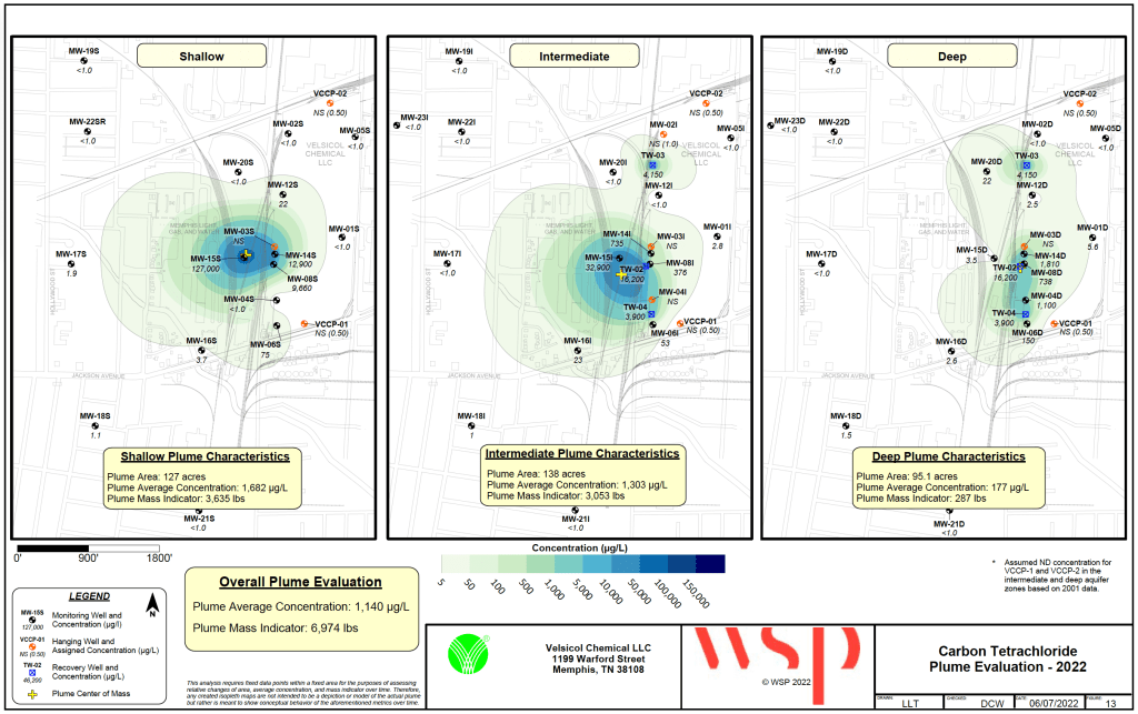
In the 1990s Velsicol Memphis plant was the main producer of chlordane in the United States, which was banned for use in America but still allowed to be sold internationally, with this plant continuing to produce 2.5 million pounds of the chemicals chlordane, endrin and heptachlor for global export until 1997. Once the company stopped production later that decade, they later reported a subterranean plume of chemicals that was roughly of the Liberty Bowl stadium, approximately 126 acres in size, which is located in Memphis, the plume contained 80,000 pounds of carbon tetrachloride. Hex can be produced as a byproduct of creating carbon tetrachloride. Velsicol has also been attempting to cleanup Cyprus Creek, with lab tests in 2023 showing contamination exceeding EPA’s limit at the neighboring apartments on Springdale St, where aldrin, endrin and dieldren were found; which are chemicals linked to neurological, reproductive and developmental harm.
As far as pollution in the waterway, Cyprus creek feeds the Wolf River and eventually the Mississippi River, so any pollution or industrial chemical contamination is likely to spread to a large number of people who live on or near these waterways or have private wells that pull from groundwater contaminated from miles away. Velsicol has a network of wells in order to calculate the boundary and weight of the plume, made mostly from carbon tetrachloride; the wells are estimated to remove 2,229 pounds of carbon tetrachloride annually. Even though the plume has reduced from 80,000 pound to 7,000 pounds of carbon tetrachloride, that doesn’t mean the danger is gone even though Velsicol claims the plume is “under control”.
The reality is the plume doesn’t stay in one place, in 2018 the plume spiked to its original size of about 280 acres, before shrinking to its current acreage, with fluctuations like heavy rainfall leading to the plume moving concentrations of the chemical downward. In 2018 the soil sample levels for dieldrin were nearly three times the EPA standard for residential properties. The most frequently found contaminant found at dangerous levels in fish is chlordane, which accumulates in their fatty tissues, posing a risk for people who eat the fish.
Velsicol Dump Sites
Hardeman County Dump
Toone, Tennessee
Hayden Chemical Company would use the site as a landfill from 1964 – 1973, disposing of approximately 130,000 drums of plant waste. In 1979 the EPA identified groundwater contamination in private wells prompting the city of Toone to connect businesses and residences to the public water supply, following the contamination in 1983 the site was added to the Superfund NPL.
There was a 242 acre parcel in Toone, Tennessee where Velsicol took their chemical waste to be disposed of in a 27 acre burial site on that parcel, dumping pesticide manufacturing waste and volatile organic compounds (VOC’s) from 1964 – 1973. Approximately 300,000 drums of chemical waste were dumped, at 55 gallons per drum estimate that’s over 16 million gallons of waste from pesticide production.
The EPA found contamination in 1980, they found pesticides and heavy metals in the surface soil, groundwater and pond sediments at the landfill, with an estimated 10,000 people living within 3 miles of the site and in a heavy area of concern. The same year the EPA took emergency action trying to stop the movement of contaminants from the site, installing a chain link fence and beginning an on-site waste monitoring program. The following year in 1981, the EPA started to remove surface level contamination.
With investigations of the site there was soil contamination found at 60 to 70 feet below the base of the landfill and an estimated 3.6 million cubic yards of soil underlying the wastes were contaminated, even private drinking wells in the nearby area were impacted by the groundwater contamination, a municipal water supply connection was then provided. There is a 1,700 acre groundwater plume that comes from the site and spreads to down gradient streams and wetlands; carbon tetrachloride, which is the primary contaminant in groundwater, has a maximum contaminant level of 5 micrograms per liter, the measured concentrations over a large port of the plume exceeds 5,000 micrograms per liter and they’ve even recorded concentrations as high as 64,000 micrograms per liter.
North Hollywood Dump
Memphis, Tennessee
From the 1930’s til 1963 the site was used as a municipal landfill. In total the property was 171 acres, 70 acres of that was for the landfill, a 35 acre abandoned dredge pond, two former surface water impoundments for another 13.5 acres and a forested buffer area. The waste was generated by the production of sodium hydrochloride, Velsicol would buy Hayden Chemical Company and continue dumping chemical and industrial waste at the dump on the 27 acre landfill, other industrial companies would use the landfill over the years too.
Health Consultation- Abandoned Dredge Pond
Prepared by Tennessee Department of Health
Sterling vs. Velsicol Chemical Corp.
People who lived near a Velsicol dump site, referred to by the company as a farm, filed a lawsuit against Velsicol in 1986, with attorneys for the plaintiffs arguing Velsicol may have pocketed from $23 to $63 million from not paying for proper chemical disposal.
“Velsicol has taken the position that without the farm, the Memphis plant would close,” reads the court case. “Thus, the Court believes that it would be appropriate to deprive Velsicol of a reasonable part of the profit it made by improperly disposing of those chemical wastes to keep that plant open.”
The lawsuit initially saw Velsicol held liable for millions of dollars in damages, that was overturned on appeal.
District of DC vs. Velsicol Chemical LLC
Introduction
No later than 1959, Velsicol was given private lab studies that chlordane caused birth defects in animals and by the 70’s knew that tests linked it to liver cancer. Research in the late 80’s indicated the Anacostia and Potomac Rivers had triple the amount of chlordane recommended for human consumption, the levels were high enough in 1989 that the city warned against eating carp, catfish or eel caught in the river. As of 2016, about 55% of D.C. waterways were “impaired” under water quality standards for chlordane levels.
- The District’s waterways and natural resources have been and continue to be contaminated by a toxic, cancer-causing chemical named chlordane. This contamination is directly traceable to Velsicol, the sole manufacturer of technical chlordane, which was one of the most widely used pesticides in this country until it was banned in 1988 by the United States Environmental Protection Agency (“EPA”) because of the threat it poses to human health. However, decades before that ban, Velsicol knew chlordane was a persistent toxin that would leech into waterways, disperse in the environment, and threaten human health. Indeed, by the early 1970’s, Velsicol’s internal studies had confirmed that the chemical caused cancer. But rather than halt its sales and share this information with the public or with regulators, Velsicol embarked on a years-long campaign of misinformation and deception to prolong reaping the financial rewards of selling its chlordane products, including throughout the District of Columbia, Maryland, and Virginia. This campaign included targeted advertisements for dangerous household use of chlordane and resisting the EPA’s efforts to ban continued sales of chlordane long after Velsicol knew about the chemical’s toxic effects.
- Velsicol’s efforts worked. Chlordane was one of the most common pesticides in the United States and accounted for more than two-thirds of Velsicol’s annual sales. By the time the EPA finally banned chlordane over Velsicol’s objections, more than 30 million homes and commercial structures had been treated with this toxic and persistent chemical. The year after sales fully stopped, District residents were warned not to eat certain fish caught from the Potomac and Anacostia Rivers because of continuing chlordane contamination. Chlordane continues to widely contaminate the District’s natural resources, including its waters. Addressing Velsicol’s contamination of the District with chlordane has cost, and will continue to cost District taxpayers tens of millions of dollars.
Leif Skoogfors/Corbis via Getty Images)
Courtesy of Business Insider
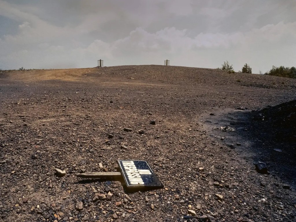
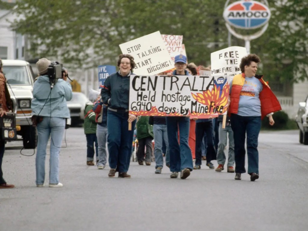
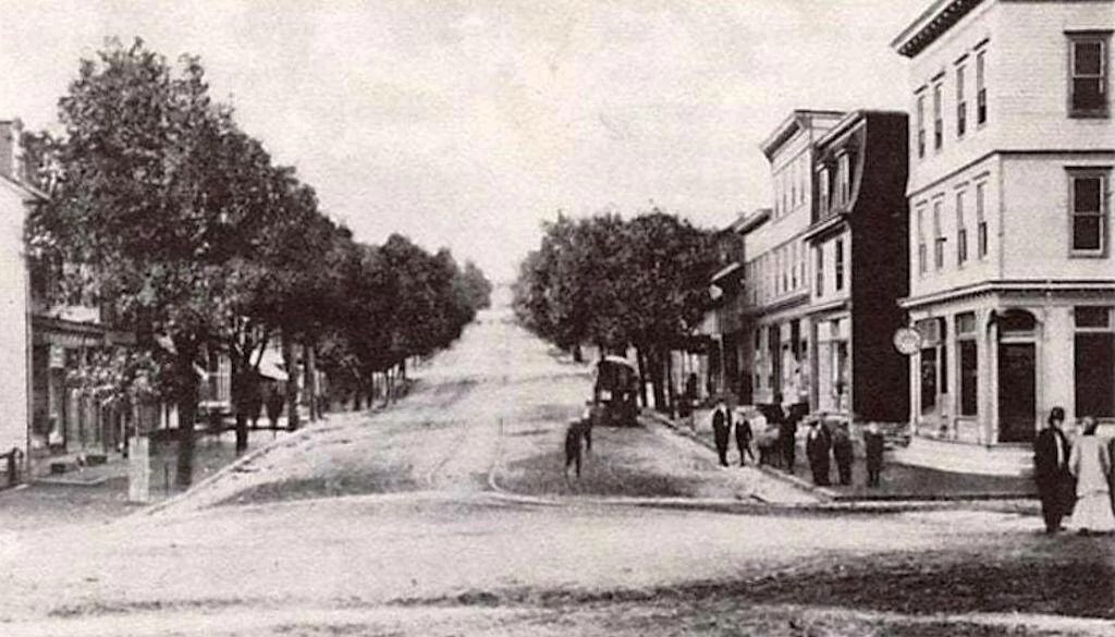
Centralia Coal Mine Fire
Centralia, Pennsylvania
The town was formed in 1811 and was originally known as Bull’s Head, later being known at Centreville before being officially incorporated as Centralia Borough in 1866, founded by mining engineer, Alexander Rae. Construction in 1854 of the Mine Run Railroad turned this town into a mining hub, connecting the community to the rest of the region and transporting coal out of the valley. By 1890, the town was home to more than 2,761 people according to the US Census, it covers roughly 155 acres and is where 1,100-1,200 people used to live prior to the 1962 mine fire starting. At its peak the town was big enough to host 5 hotels, a bank, two theaters, seven churches, 27 saloons, a post office as well as 14 general and grocery stores at its peak around 1900, there were also 14 active coal mines.
Mining for anthracite coal began in 1942 with the Centralia Colliery opening in 1862 but had been inactive since the 1930’s. Anthracite coal is what makes this area special; its high carbon content (86-97%), hardness, high energy density and the fewest impurities is what makes this type of coal highly sought after, it’s also slow burning and clean with very little smoke or particulate emissions compared to other coal.
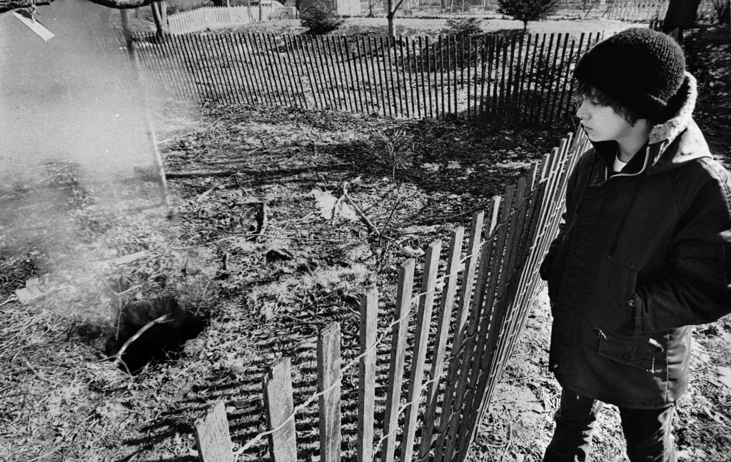
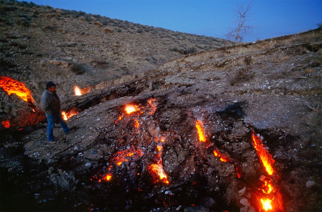
Prior to Memorial Day of 1962 the town was preparing for the celebrations by some local volunteer fireman burning some garbage on May 25th, as was the norm. At the end of the blaze they put out all the visible flames, unknowingly allowing the fire to spread into the coal seam below, for a few days after the fire- flames would continue to crop up. Random fires would continue to spring up as the coals burned, even without a visible fire the smoke and stench of burning coal permeated the town. Later it would be discovered there was a 15 foot wide hole that was several feet deep that was never filled with flame-retardant material, the fire has been able to spread through the honeycomb of coal mines ever since.
The fire that started as just the regular burning of the town’s trash, has spread to the point of devouring an area the size of 35 football fields. Some of the gas exhaust vents were measuring between 456°C (852.8°F) and 540 °C (1004°F) in 2005 and the fire below ground was recorded to be moving rapidly at a rate of 20–22 meters (65-72 feet) per year. A decade later in 2015 the average annual temperature of surface exhaust fences is roughly ~65 °C (149°F) and the spread of the fire underground is nearly unperceivable. There was an attempt to stop the spread of the fire in 1969 by creating an underground barrier using the remains of burnt coal to stop the spread of fire, it failed to do so. Other attempts had failed including pumping water into the shafts which left the town at risk for steam explosions, the town also tried to dump clay and slurry to stop the fire from spreading, that failed too. The cost to dig up part of the town and the remaining coal could cost approximately $400 million according to some experts, the United States Office of Surface Mining (OSM) estimated in 1983 that it could cost $663 million to extinguish the fire.
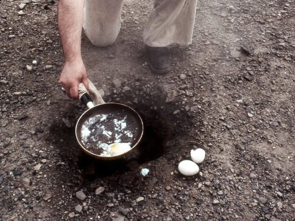
The local gas station was owned by John Coddington, he noticed in November of 1979 that there was steam rising from the lot next to his gas station, he had some concerns because he had four underground tanks that were holding a total of 9,000 gallons of gasoline. Not long after that, just a month later in December his basement floor was warm to the touch and he saw steam coming from the floor, the temperature measured 136 degrees Fahrenheit, officials began to monitor the temperature of the gas- the heat was steadily rising so the Pennsylvania Police fire marshall ordered the station to shut down. John then had to pump all the gas out and fill the tanks with water to prevent an explosion, the Coddington Gas and Service Station was demolished in 1981.
There was even a kid who fell into a hole on Valentine’s Day in 1981 that was opening up in the backyard of his grandmother, a 150 foot fissure that once served as a mine shaft opened up below him. Luckily for 12 year-old Todd Domboski his cousin, Eric Wolfgang, came to his rescue, pulling him from the hole, when the ground gave way. Todd fell about 6 feet and he had grabbed onto a tree root as the ground beneath him disappeared, likely being the only thing saving Todd, thankfully he was not injured in the fall. Town officials later measured the heat inside the hole at 350 degrees Fahrenheit.
It’s currently been burning for the last 50 years and is estimated that it will continue to burn for at least another 100 years into the future and possibly for 250 years, for the next several generations to deal with and live around. It could burn across an 8-mile stretch that encompasses 3,700 acres before it runs out of the coal fueling the mine-fire. The few people that lived there as of 2012 had no zip code as the U.S. Postal Service (USPS) revoked the zip code in September 2003, then the 10 remaining people had no mail service. As of January 2013 there were 5 remaining residents. As the fire continues to burn and emit sulfur and carbon monoxide into the atmosphere above giving off a thick poisonous air for the remaining residents to struggle through.
The government started to help in 1981, assisting families to relocate after attempts to put out the fire failed, to the tune of $3.5 million, according to The New York Times. Then in 1983 the government spent $42 million to buy residents homes and relocate residents even though some refused to leave, with 10 residents not taking the buyout. The government has tried to obtain the remaining properties through eminent domain, the few residents trying to stay put were trying to fight the federal government. By the end of the 1980’s over 500 structures had been demolished and more than a thousand people had moved from the town. In 1992, the state of Pennsylvania ordered the remaining residents out but gave them one last chance for the buyout program, the state issued an Eminent Domain fIn the 1990’s a handful of residents who had their homes seized filed a federal lawsuit that accused the government of wanting the towns coal and claimed the parts of town where they lived were safe. The residents won and were allowed to stay as long as they live and also each received a cash payout of $349,500, but they could not sell or give away the property, once they pass the state will seize the land and demolish the remaining buildings.
As of 2008 the fire underground spans over 350 acres and is burning 300-400 feet below the surface, reaching a temperature of up to 1,400 degrees Fahrenheit. A geologist in 2012 with the Pennsylvania Department of Environmental Protection said that the fire that’s existed underground for decades may have gone deeper underground, it still poses a threat because it has the potential to open new pathways for deadly gases to reach the remaining homes. The residents who stay behind say that’s nonsense because they’ve lived in their homes for decades without incident. According to the U.S. census in 2020, it showed only 5 residents still living in what’s left of the mining town.
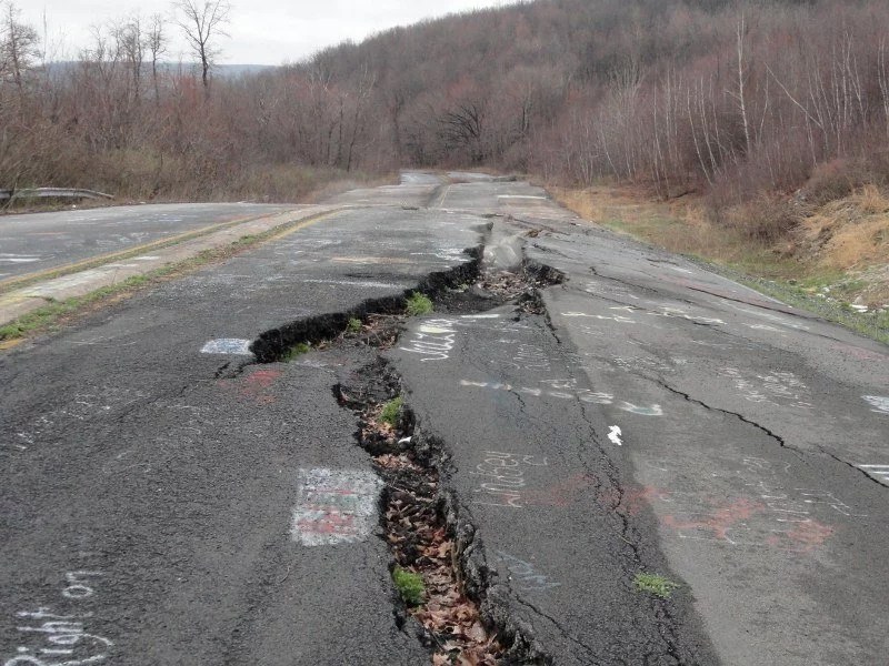
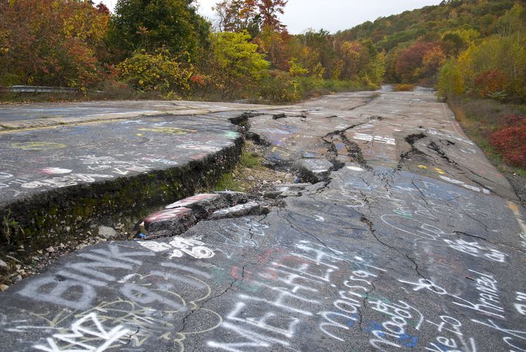
The town’s eerie look was even part of the inspiration the French-Canadian horror franchise, “Silent Hill”. It was also known for what was called “Graffiti Highway”, a stretch of Pennsylvania Route 61 that was damaged by the underground fire and led it to be a canvas for graffiti artists, was closed indefinitely in 1993 and it was later covered with dirt in 2020 to deter tourists from visiting.
“Even the dead cannot rest in peace,” wrote Greg Walter for People in 1981. “Graves in the town’s two cemeteries are believed to have dropped into the abyss of fire that rages below them.”
Link to Fire Location Map
Link to Centralia Fire
Potential Spread Map
Centralia Mine Fire Mercury Study
Final Report – March 2008

Courtesy Business Insider


Courtesy of R. Miller/FlickrCentralia
Leif Skoogfors/CORBIS/Corbis via Getty Images
Courtesy Business Insider
Courtesy Historic Mysteries

Courtesy Business Insider
Courtesy Historic Mysteries

Courtesy Business Insider

Courtesy Business Insider

Courtesy Historic Mysteries
Courtesy Changes in Longitude
Courtesy of Treehugger

Courtesy Business Insider
Courtesy Business Insider

Bettmann/Getty Images

Courtesy Historic Mysteries

Courtesy Business Insider
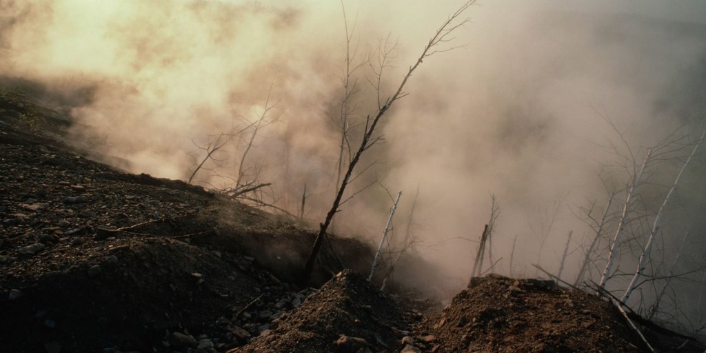
Last Updated: May 27, 2025
Courtesy of The History Channel

Libby, Montana
Asbestos Disaster
Center for Asbestos Related Disease
Libby Asbestos Site – Overview
Follow-Up of the Libby, Montana
Screening Cohort
There was a mine in Libby, Montana where gold minors discovered vermiculite in 1881, with mining companies first starting to mine vermiculite ore in 1919 with the Zonolite company being formed in the 1920’s and starting to mine the vermiculite, then being sold in 1963 to W.R. Grace with the mine eventually closing in 1990. While in operation the mine was producing a significant portion of the world’s vermiculite, approximately 80% of the worlds supply, but that vermiculite was contaminated with a toxic form of asbestos and that contamination would lead to severe health problems in residents and the surrounding areas.
Known commercially as Zonolite, tremolite-actinolite series asbestos, often called Libby Amphibole asbestos (LA), is known to cause lung disease and other breathing problems, was used as construction material including insulation for homes and businesses thanks to its heat-resistant properties but it was used in other places such as ball fields, people were allowed to come pick up as much as they wanted for their attic or to use in the garden. As naturally occurring minerals, asbestos and vermiculite form under similar conditions and sometimes the two minerals develop alongside each other, such as in Libby where a toxic and highly friable (materials that easily crumble or break into powder) form of asbestos, contaminated the vermiculite deposit.
It was by 1956 that Zonolite had known about the asbestos risk but didn’t tell their employees, when W.R. Grace took over the mine in 1963 they knew the vermiculite was contaminated with asbestos and that it caused health problems, they didn’t they inform anyone about the asbestos exposure and yet they continued to operate the mine until 1990. There was a company report in 1965 that had a long list of employees with “abnormal chests” with many of those who already had died from lung disease. There was a study published in 2021 in the Journal of Exposure Science and Environmental Epidemiology, that estimated 694 Libby residents have died of asbestos-related diseases and the study also showed a 15-fold increased risk of mesothelioma among the workers of W.R. Grace compared to residents who didn’t work around the mine.
The EPA got involved in 1999 after concern from citizens, local government and media about possible exposure to asbestos from the nearby vermiculite mine, there was an investigation done by the EPA that showed Libby Amphibole asbestos to be present in air both indoors and outdoor ambient, in vermiculite insulation and bulk materials, indoor dust, water, dirt, animals, fish and various other media. With removal actions starting in 2000, the site was placed on the National Priorities List in 2002 and in 2009 for the first time ever, the EPA declared a Public Health Emergency in Libby in order to be able to provide federal health care assistance for victims of asbestos-related disease. The amount of LA in the air in downtown Libby is now nearly 100,000 lower than it was when the mine and mill were in operation.
There were more than 800 plaintiffs who filed lawsuits against Maryland Casualty Co., now owned by Zurich Insurance, which provided the workers’ compensation insurance coverage for the W.R. Grace & Co. mine, from 1963 – 1973. Maryland Casualty Co. had suggested workers take annual x-rays and made worker safety recommendations. A former mine worker at the W.R. Grace mine, Ralph Hutt, had his case chosen as a lead case to settle some of the complex legal questions and set parameters for other cases that are against the insurance company, he was awarded $36.5 million in damages. Montana Supreme Court ruled in March 2020 that the insurance company should have warned Hutt and others workers about the risk of exposure to airborne asbestos. There was even an internal Maryland Casualty memo, that had an assigned insurance defense council recommended settling a workers compensation claim in 1967 against Grace to avoid exposing “all of the more damaging aspects of our own situation.”
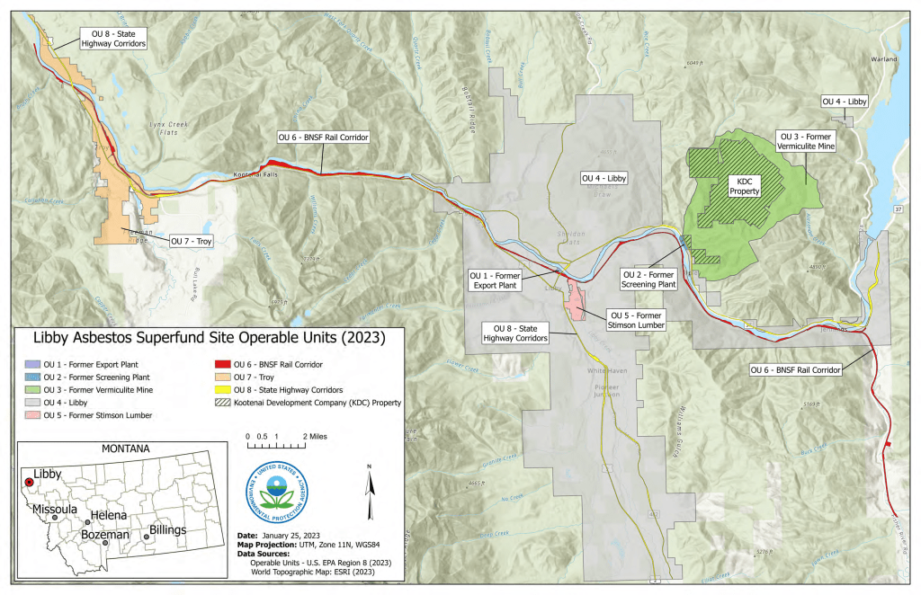
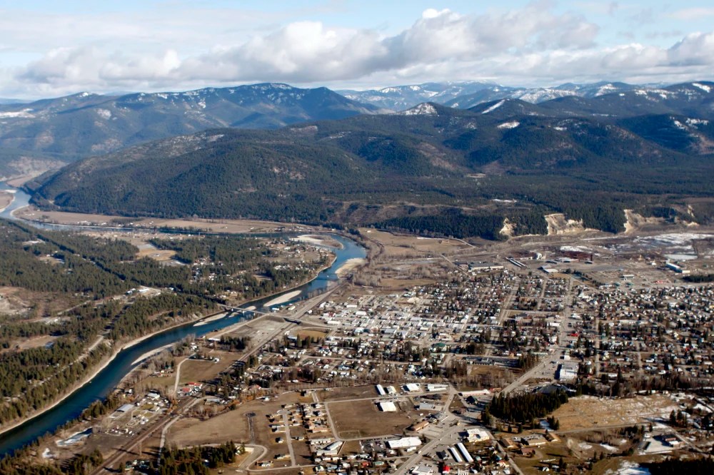
Berkeley Pit –
Butte, Montana
The Richest Hill on Earth
Continental Mine Reclamation Plan
It was once an open pit copper mine that started operating in 1955 until 1982 when the water pumps were shut off by ARCO in the Kelly mine, approximately there were 320 million tons of ore and 700 million tons of waste rock were mined, with enough copper being produced to pave a 4 lane highway four inches thick all the way for Butte to Salt Lake City and 30 miles beyond, when that when the mining was done at this site there was a massive hole left in the ground that’s a mile wide, 1.5 miles long and a 1,600 feet deep. The bigger problem was when the mining ceased, the dewatering pumps were switched off and that led to groundwater mixing with the exposed minerals in the tunnels and pit, gradually accumulating in the open pit which ended up creating a toxic lake with dangerously high levels of heavy metals like arsenic, zinc, cadmium and sulfuric acid as well as other contaminant.
The leftover toxic water is so hazardous that thousands of migratory birds deaths have been recorded over the years as they land on the highly acidic and metal-laden lake. Long term exposures to the toxic substances and heavy metals commonly associated with the pit can lead to serious health issues including respiratory problems, skin disorders and an increased risk of cancers such as lung and kidney cancer due to arsenic silica particulate exposure. Now the project is to keep birds from landing on the water so toxic it will cook them from the inside out, by drones, fireworks, lasers, sonic cannon and gun shots.
There are over 10,000 miles of underground mines, many leading to the old open pit, enough to cross the United States three times. In 1983 the Montana Bureau of Mines and Geology received funding from the Montana Legislature to be able to implement a supplemental groundwater and seismic monitoring network in response to concerns about impact to local properties from groundwater rebound and potential to trigger local seismic events (earthquakes) in relation to the Anaconda Companies’ suspension of mining and dewatering of the Butte mines.
The EPA determined by 1994 that it was “technically impractical” to remediate the contamination found in the mine pit turned toxic lake. There is a Horseshoe Bend Water Treatment Plant that was constructed by the EPA, it can treat 7 million gallons of water per day from the Berkeley Mine and surrounding mines, the plant is able to remove heavy metals and neutralize acidity before the water enters the Silver Bow Creek or the Clark Fork River, there are also storm-water channels to direct water from the mining site into the Berkeley Pit to keep contaminated runoff from reaching the groundwater.
The MBMG (Montana Bureau of Mines and Geology) would be responsible for operation and long-term maintenance groundwater/surface-water monitoring program, after a 2002 settlement, referred to as a Consent Decree, between the EPA and the Montana Department of Environmental Quality and a number of potentially responsible parties; with the EPA, Montana DEQ and the potentially responsible providing funding for the monitoring which includes 12 abandoned underground mines shafts, 63 dedicated monitoring wells, 5 surface-water monitoring stations and the Berkeley Pit itself. Surprisingly the pit contains some life, extremophilic organisms have been found in the Berkeley Pit, extremophiles are organisms that can live in extreme conditions, researchers have identified many different species of microorganisms in the pit and research continues to understand these communities.
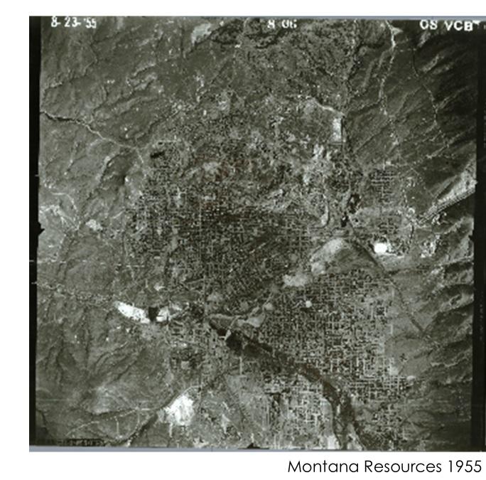
Source: Courtesy of Montana Resources
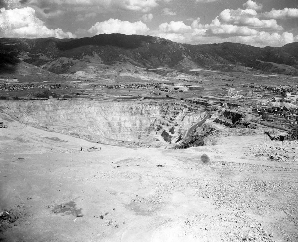
Source: Butte-Silver Bow Public Archives, Smithers.11.231.03
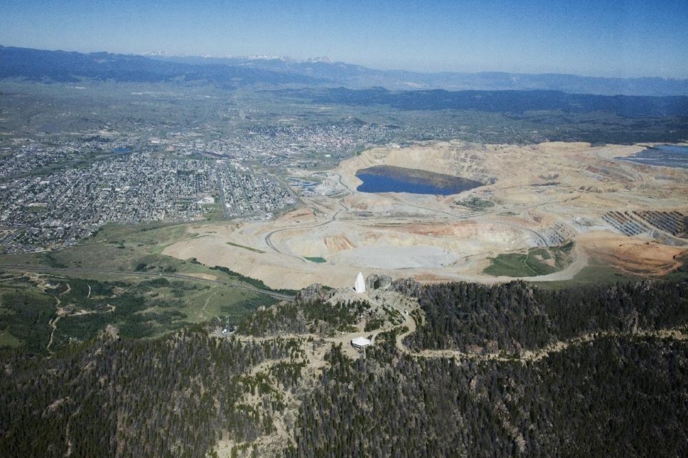
Source: Geoff Weston photograph, Butte-Silver Bow Public Archives

Source: Courtesy of Montana Resources.
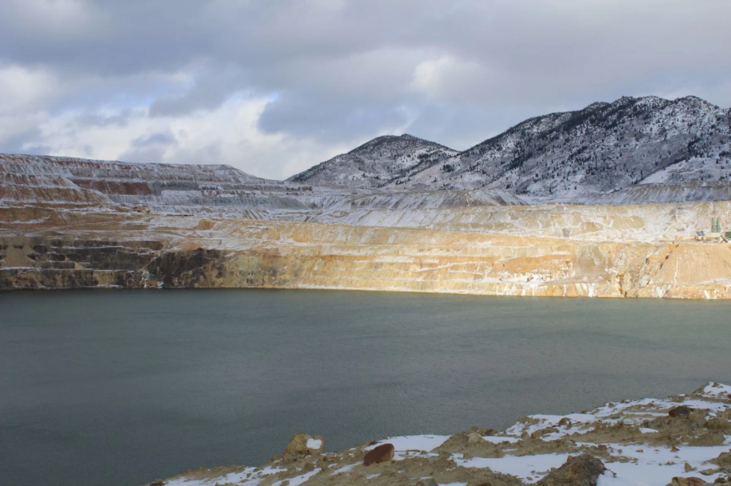
Courtesy Montana Public Radio
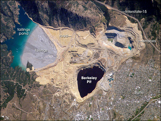
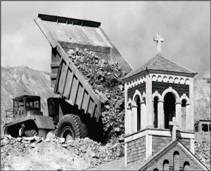
Courtesy of Ripple
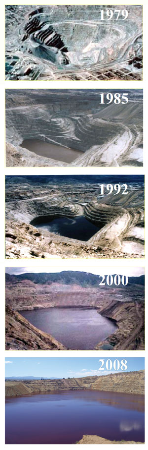
Courtesy of Ripple
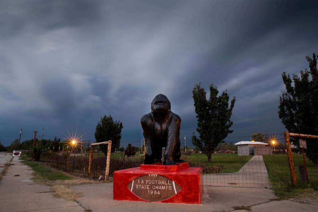
Courtesy Politico
America’s Worst
Environmental Disaster
Picher, Oklahoma
The Environmental Scandal in Scott Pruitt’s Backyard
The challenge posed to children’s health by mixtures of toxic waste: the Tar Creek Superfund Site as a case-study
Quantitative analysis of the extent of heavy-metal contamination in soils near Picher, Oklahoma, within the Tar Creek Superfund Site
Potential health impacts of heavy-metal exposure at the Tar Creek Superfund site, Ottawa County, Oklahoma
Airborne Lead (Pb) From Abandoned Mine Waste in Northeastern Oklahoma, USA
Northeastern Oklahoma Mining Natural Resource Damage Assessment and Restoration Site
A Superfund Case Study: 10 Years at Tar Creek
A Suite of Options at Tar Creek
The earliest mining and ore discoveries in the area was in the area of Peoria in 1891, there were a few other major ore discoveries nearby but the real expansion of zinc and lead mining was after a major ore discovery near Picher in 1914, Picher would form after a zinc and ore strike on land belonging to Harry Crawfish, a full-blood member of the Quapaw tribe. The Federal government had forced members of the Quapaw tribe to sign unfavorable leases in the mid 1890’s under the pretext that they were “incompetent”, basically that they were incapable to use their own land profitably. In late 1913 the town started developed around the mining of lead and zinc ore that was found nearby, it was named after the owner of the Pitcher lead company, O.S. Picher and the town became incorporated in March of 1918.
This little town happened to have the most productive mining field in the Tri-State Lead and Zinc District which consisted of Oklahoma, Kansas and Missouri, producing more than $20 billion in ore from 1917-1947 according to the Oklahoma Historical Society, with over half of the lead and zinc used in the First World War being from Picher. By 1918 the section of the Picher field located in Oklahoma was well defined with 230 mills built or under construction, the population of the town would reach 30,000 people at its peak. The area was so rich in mining activity that there were 1,400 mine shafts in Picher, having 75 million tons of lead-contaminated tailings and 36 million tons of mill sand and sludge being left behind; there were 248 ore refining mills in the Picher field in 1927 until late 1930’s when centralization of the mills resulted in mill consolidation.
To this day, scientists still don’t know how to clean up all the pollution that devastated local communities and continues to do so, the Tar Creek is an 11 mile waterway that begins in Kansas and flows through several communities, sadly in 1979 the creek turned bright orange from the mine water that was dumping toxic elements such as lead, zinc, arsenic and cadmium into the creek. What was once a thriving mining town with so many families calling it home, it would later come to be known as one of America’s “toxic ghost towns”; the buildings that weren’t destroyed by fire or tornado, demolished or collapsed are all abandoned and dilapidated, complete with a gorilla statue that was a memorial to the former schools football championship in 1994 overlooking a parking lot.
The site known as the Tar Creek Superfund Site is a 40 square mile area and came to the attention of the EPA and the state government in 1979 when water started flowing from the underground mine in to Tar Creek, when that happened much of the downstream animal and plant life in Tar Creek were killed off as a result. There was growing concern with the EPA that acid water would be contaminating the area’s soil and groundwater, millions of dollars would be spent trying to cleanup the Tar Creek site and the town of Picher but it wouldn’t be enough.
There were over 14,000 men who worked in the Picher mines alone over the years, all the men working in the Tri-State Lead and Zinc District were more susceptible to silicosis, tuberculosis, lung cancer and liver failure than the average person, the Oklahoman reported. It wasn’t just the mine employees who were at risk as the mining went on, the more ore that was mined meant there was more chat that was left as a byproduct of the mining, with piles growing taller every year, even after mining stopped in the early 1960’s; while mining operations had essentially ending by 1974, the area still struggled. The wind would blow lead and other heavy metals from that chat piles and the rain would let it leach into the ground, some of the more than 30 major chat piles are 200 foot high mounds of lead and a zinc mining tailings, approximately 30 million tons of chat sit across the area. For every ton of ore that was extracted at the site, there were over 16 tons of chat left behind.
That’s not to mention that when mining stopped in 1967 there were more than 1,000 mineshafts and around 100,000 exploratory bore holes in the Oklahoma part of the mining district leaving over 300 miles of underground mines and tunnels, it’s estimated that when mining ceased there were underground cavities left from mining that had a volume of 100,000 acre-feet (161,000,000 CY). When the mineshafts weren’t sealed at the end of mining operations, it lead to acid mine water seeping to the surface, the acid mine water also seeped into the groundwater and in nearby Tar Creek. The mining underneath the town of Picher was so close to the surface it lead to sinkholes that filled toxic water. The town of Picher didn’t just sit on top of zinc and iron ore deposits, it also had an aquifer known as Boone aquifer that became a problem as the mining went deeper into the earth.
Exposure to lead can cause children “damage to the brain and nervous system, slowed growth and development, learning and behavior problems, and hearing and speech problems,” according to the CDC. The Indian Health Services started to notice high blood lead levels in local children in 1994, showing 35% of the Native American children in the area had concerningly high blood lead levels, with another area study that showed young school children had over 43% elevated blood lead levels, 11 times the state average.
“There actually is a million and a half gallons of bad-acid mine water, full of heavy metals, coming out of and down Tar Creek every day,” says Rebecca Jim, Executive Director of the LEAD Agency, according to KOAM news. There has been over a million gallons of contaminated water per day being discharged into the Tar creek for over 40 years, killing most of the aquatic life,
In 2006, there was a federal study showing the danger of caving due to significant undermining that put 159 homes, businesses and public buildings at risk of caving in, since the 1982 inventory by the Oklahoma Geological Survey there have been 35 cave-ins the report stated. With everything that had happened, US Sen. Jim Inhofe led the call for a buyout for the residents to relocate away from the potential danger, over the next two years over 200 families would relocate thanks to the federal money. There was an earlier study after the site came to the EPA’s attention that showed 86% of the towns buildings including the towns school, had been undermined.
Since roughly the 1830’s the land in Ottawa county was inhabited by the Quapaw tribe, much of the area is considered Indian land and held in trust by the American government for the members of the Quapaw tribe, because Native Americans have so many reasons to trust the American government. The people of the Quapaw tribe beared the consequences of the disastrous mining practices, were forced off their land and were disproportionately affected by the contaminated water by how close to the Tar Creek site they reside. The area is also known for higher cancer rates than the rest of the state, there are now 4 dialysis units in the small town of Miami, which has a population of less than 13,000 people.
There were plans presented to the EPA on dealing with the chat piles and fine tailings in the 1980’s with the site being added to the Superfund list in 1983, one of which was a wastewater treatment plant to pump the water out from the mines and to clean the water, lowering the water table and keeping the wine water from surfacing, which would help the community by cleaning the water for use and for farmers use in irrigation while also pulling the heavy metals from the mine water to be sold to help pay for operations. The EPA has continually dismissed the plan during each of its five-year review plan even though officials from the George W. Bush administration also reviewed the plan and recommended it as a solution. Other plans that the EPA has tried haven’t worked and there is still acid water from the mines flowing into tar creek. The plan for the wastewater treatment facility was rejected because it was going to cost $60 million and by 2018 it’s cost $500 million or more for the buy-outs and cleanup at the site so far, and only 600 of the 26,000 acres had been cleaned up. By October 2023 there had been 2,500 acres have been reclaimed for reuse and a total of 8.8 million tons of chat waste material that’s been removed/ disposed of.
Sadly in 2008, there was an EF-4 tornado that destroyed the southern half of the town, which left 8 dead and 150 inured with over 100 homes destroyed, this tragedy let to more of the remaining residents to relocate but still some stayed, with The Oklahoman reporting in 2008 that some residents felt that the buyout wasn’t enough to start over somewhere else, after the tornado hit the EPA determined the town was dangerous to inhabit. The EPA completed a buyout of all residents and evacuated the town in June 2009, the city government then officially cancelled Picher’s incorporated status on September 1st 2009. The Census showed there were 20 residents remaining in 2010 within the boundaries of the former town of Picher, in the early parts of 2010 the demolition of houses and buildings began, there were only 6 residences and one business house by 2011. The town officially dissolved in November of 2013, the EPA and the State of Oklahoma have spent more than $300 million on cleanup and the creek still runs orange.
Courtesy of The Revelatory

CLIFTON ADCOCK/The Frontier

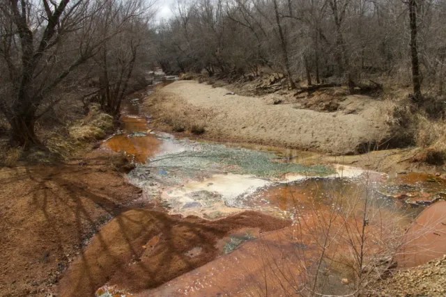
CLIFTON ADCOCK/ Courtesy of The Frontier
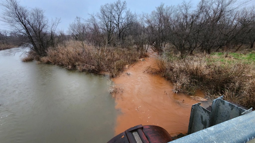
Courtesy KGOU / Summer King – Quapaw Nation
Courtesy of Politico
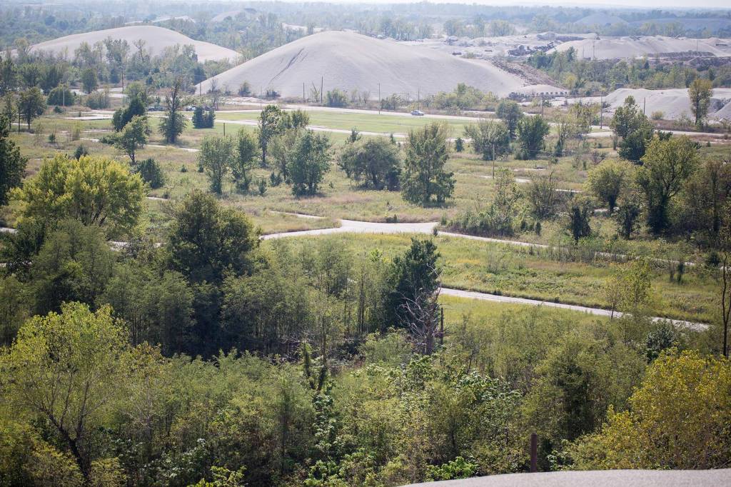
Courtesy Politico
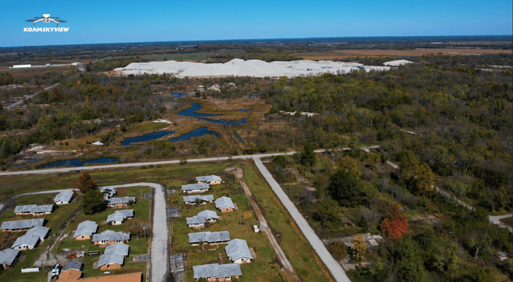

Courtesy Politico
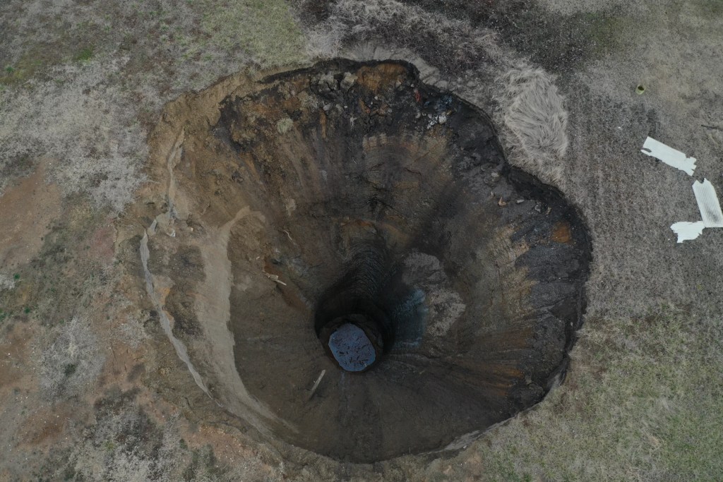
Courtesy KGOU / Summer King – Quapaw Nation
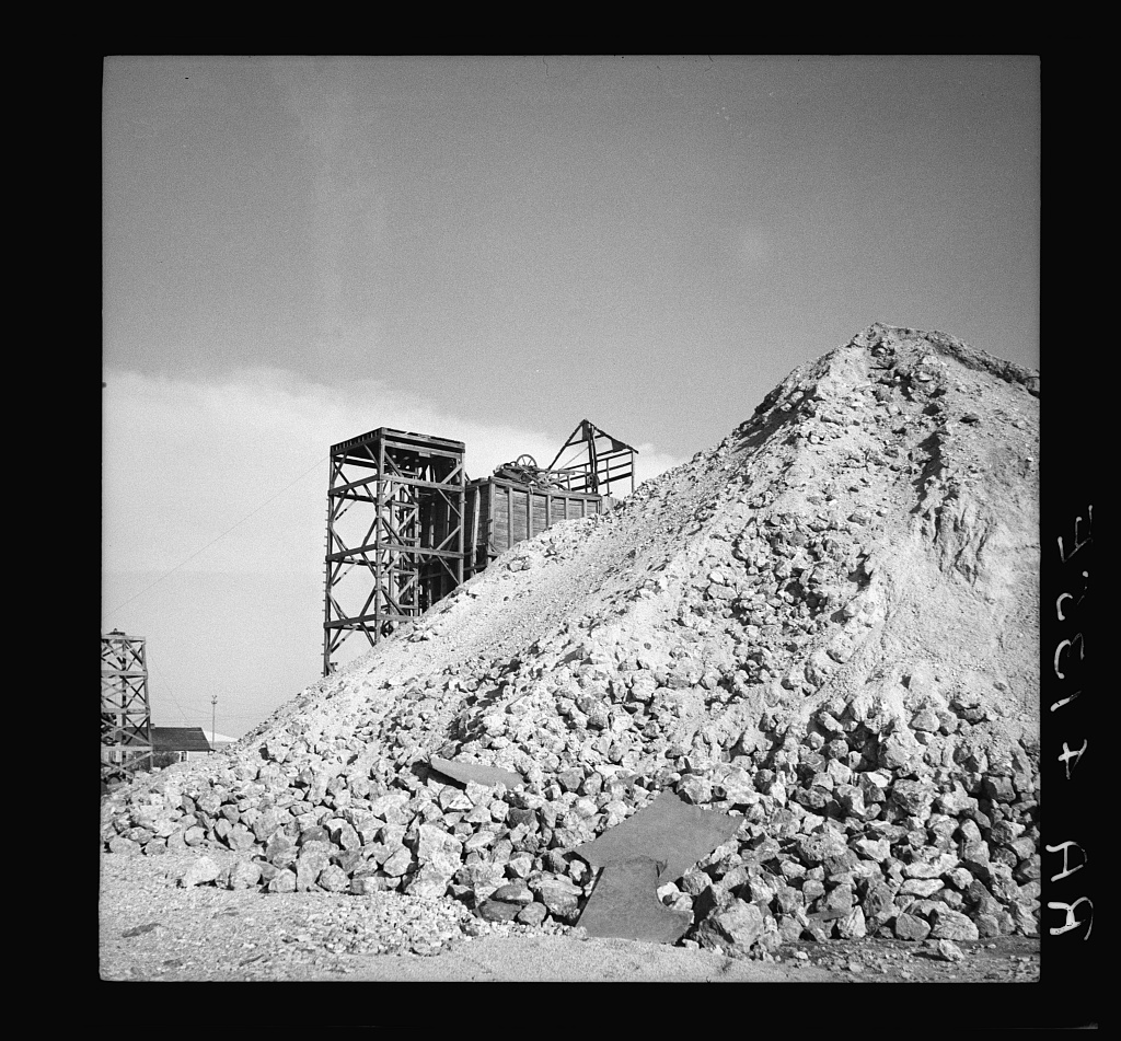
Courtesy of The Revelator
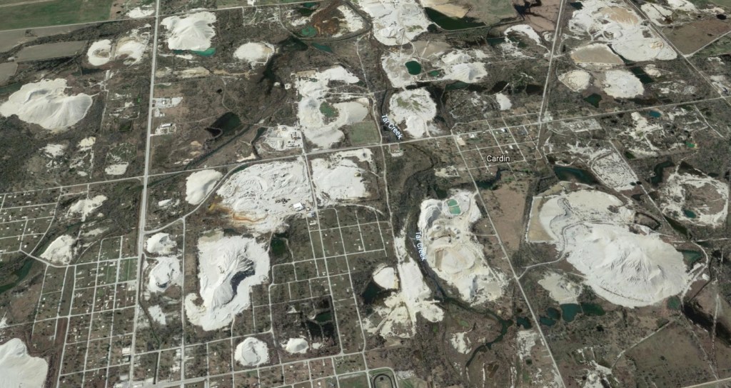
Photo: Google Earth. Courtesy of The Revelator
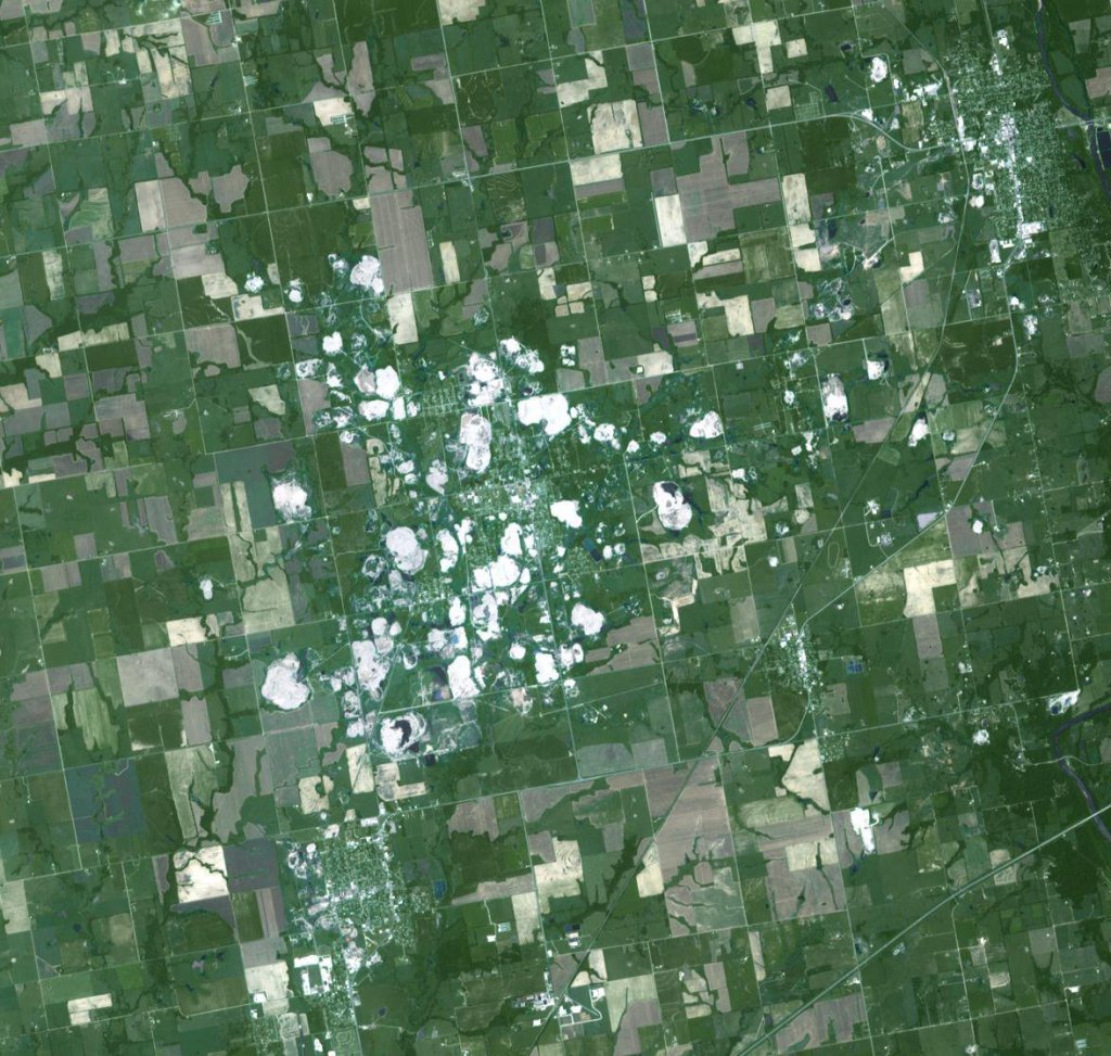
U.S. Steel Site
Duluth, Minnesota
Fourth five-year review report for St. Louis River Superfund Site
The site was a former steel making, coke production and wire mill facility built in 1907, now it’s a 600 acre superfund site, 100 of those acres is river sediment. The site is on both the federal National Priorities List as of 1983 and the Minnesota Permanent List of Priorities, with 19 Operable Units for remediation in both wetland and upland areas. While in operation the plant produced a variety of solid, semi-solid and liquid wastes, some of which were released onto the surrounding land and in the unnamed creek (known as Steel Creek) which discharges into the St. Louis River, including heavy metals, dioxins and polycyclic aromatic hydrocarbons (PAHs) from coal tar. The plant started production in 1915 with steel making ending in 1974, coke production stopped in 1979 and wire mill ended soon after in 1981.
There were water quality surveys done over the years showing progressive deterioration of the water quality and biota of Spirit Lake and the St, Louis River estuary near the steel plant, the studies were done in 1928, 1948 and 1973. There were contaminates found as early as 1929 by a study conducted by the Minnesota State Board of Health, the Minnesota Commission of Game and Fish and Wisconsin State Board of Health. The later study by the Minnesota Pollution Control Agency in 1973 found high ph, high Biological Oxygen Demand and high concentrations of phenols, cyanide, and ammonia in coke plant settling basin.
After the MPCA requested that U.S. Steel have a hydrological study, there were two reports submitted, “Soil and Ground Water Investigation” in 1981 and “River Water Quality Impact Investigation” in 1983, and that same year is when the site was added to the National Priorities List. The EPA in a 1995 agreement formally turned to MPCA as the lead enforcement agency over the site, then in 2016 the MPCA asked the EPA to take the lead project management role for the contaminated aquatic sediment Operable Units and and associated areas without an OU designation. There was also
When U.S. Steel was demolishing the coke plant and wire mill, as well as creating two on-site landfills, the Minnesota Pollution Control Agency (MPCA) was watching over the work being done. The company also removed 6,487 tons of waste from settling basin and disposed of it off-site and solidified 10,000 cubic yards of coal tar and contaminated soil for on-site disposal.
The company notified the MPCA in 1979 of the intent to close the coke and steel plant, a majority of the buildings were demolished by the end of 1988 and all but one of the buildings were removed by 1999, the site is currently owned and managed by U.S. Steel.
U.S. Steel
St, Louis River Site
On top of the contamination at the U.S. Steel site, there’s another state-managed Superfund sites that is known as St. Louis River/ Interlake/ Duluth Tar (SLRIDT), which has 225 acres of land, boat slips and bays of the St. Louis River. There’s also contamination that was getting into Spirit Lake, which has an island located within called Spirit Island, it’s a sacred place for the Fond du Lac Band of Lake Superior Chippewa.
The clean-up started in October 2020 with a cost of $165 million, by dredging the sediment from the waterways, isolating and capping sediment from the environment and long term management. The dredged sediment material will be stored on site long-term in Confined Disposal Facilities, with 1.3 million cubic yards to be remediated; 460,000 cubic yards removed and 850,000 cubic yards capped which covers 96 acres of aquatic habitat.
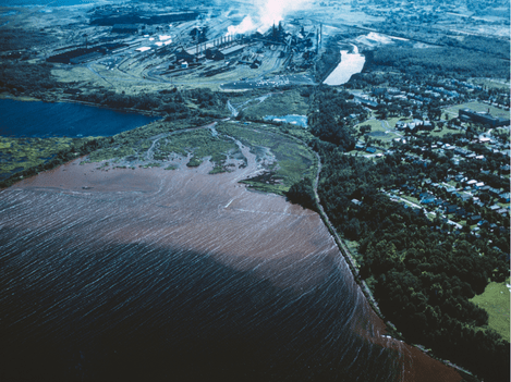
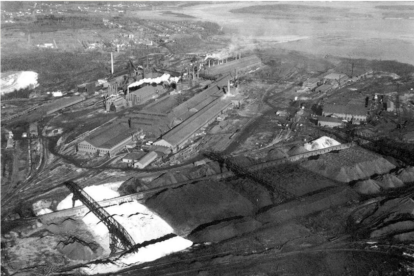
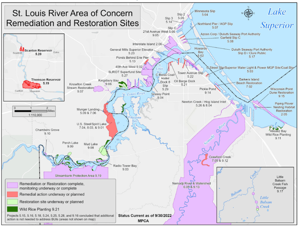
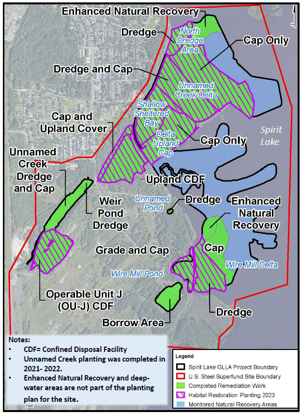
Courtesy of Great Lakes Mud
U.S. Steel
Geneva Works
Orem, Utah
Rocky Mountain Arsenal
Denver, Colorado
The United States Army acquired 27 square miles of land, 17,000+ acres, which is roughly the size of Manhattan, with that they established the Rocky Mountain Arsenal (RMA) in 1942 to manufacture 87,000 tons of chemical, intermediate and toxic products, also chemicals weapons such as chlorine and mustard gas as well as 150,000 tons of incendiary munitions for use in World War II, manufacturing capability was expanded to include napalm, white phosgene and rocket fuel (hydrazine).
After the war and all the way up to the early 1980’s the U.S. Army continued to use the facility, from 1950-1952 the North Plants complex was built by the Army to manufacture nerve agents such as VX and GB (also called Sarin, one of the most dangerous and toxic chemicals known). The North Plants facility was a 5-story windowless, concrete monolith, built with 5-foot thick concrete walls to withstand a direct hit from a nuclear warhead. There were over 750 hazardous chemicals handled or generated at the site. During the late 1950’s and early 1960’s, the RMA was working on developing a biological agent called TX (a weaponized form of wheat rust, a fungal disease that attacks crops). Later during the 1960’s activities at the plant supported efforts in the Vietnam War by manufacturing land mines and white phosphorus incendiary devices.
Following WWII the Government decided to operate a lease program to offset operational costs, foster economic growth and maintain facilities for national security. In 1946 Julius Hyman and Company began producing pesticides, in 1952 the company was acquired by Shell Chemical Company who continued production of pesticides on site in the South Plants complex until 1982, resulting in widespread and significant environmental contamination across the site known as Rocky Mountain Arsenal. Some of the products produced by Shell Chemical Company included organochlorine pesticides aldrin, dieldrin, and endrin, neurotoxins that have been proven to be so persistent and bioaccumulative in the body they were banned for sale decades later.
There were more than 600 chemicals used or manufactured at the arsenal including volatile organic compounds, heavy metals, pesticides and Diisopropyl methylphosphonate (DIMP). DIMP is a manmade chemical unique to the Army’s manufacture of Sarin nerve gas, it’s a colorless, odorless and tasteless liquid, it also has no known commercial uses but has been found to affect the hematological (blood forming) system in animals. Rocket fuel was also blended for the Delta and Titan missile operations on-site.
Originally the Army was discharging waste into a large, open lagoon referred to as Basin A, that basin was created by taking a large depression in the ground and enhancing it. They started trucking waste over to Basin A with open ditches also being used to convey waste chemicals to Basin A, later on they had chemical sewers constructed to take the waste directly to Basin A from the North and South Plants. It wasn’t til Basin A overflowed and they created Basin B, when the second basin reached capacity they constructed Basin C, followed by Basin D and Basin E, one after the one once the previous one filled up, also requiring more sewers and more ditches to move the waste material. Once the Army realized contamination was spreading off site they constructed Basin F which was asphalt lined, problem was the asphalt lining wasn’t resistant to the chemicals it was designed to contain, the contamination footprint was huge by this point and Basin F by itself was 93 acres. In order to reduce the amount of the liquid waste material in Basin F, they installed spray nozzles to spray waste chemicals in to the air, cause that’s just a great idea, it caused a widespread, diffuse surface soil contamination footprint downwind of the lagoon.
Between the manufacturing process and waste disposal process there was extensive soil, surface water, sediment, groundwater and structures contaminated, even the trees and vegetation had damage plus death to wildlife. There were burn pits and trenches where solid and liquid chemical hazardous waste was disposed of, it also pooled in open basins covering wide areas. One of the genius ways they were discarding of waste in the central/east portions of the site including surplus desks, vehicles to off-spec munitions and chemicals, was to dump it in a trench, cover it with napalm and burn it, so thoughtful of them. Other waste pits called Lime Basins, they were several one-acre pits which were constructed to dispose of waste mercury, off-spec mustard, Lewisite and other chemicals; the waste was mixed with caustic lime to neutralize the agents.
Spills were also present in multiple areas from storage areas, central processing areas and out of chemical sewers that existed underground. Some of the waste spills that were identified included 100,00 gallons of benzene in 1947, another leak happened in 1978 with 58,864 gallons of DCPD and 87,000 gallons of other solvents, pesticides, and metals (CDPHE, 2007); there were some other leaks including one that affected a nearby farm in the 1950’s which had livestock with high levels of contamination. There was a large storage yard with rows of pallets that contained waste chemicals and off-spec pesticides that were stored in drums, many of those that had leaked as well as were subject to wind spread dispersion. There was another storage yard that stored chemically configured munitions that were leaking in bunkers so they were brought up the storage yard, other places on the site were used for munitions testing.
The first discovery of groundwater contamination migrating off of the Arsenal was in the mid-1950’s when crop damage and affected livestock with animal deaths was noted on farms north and northwest of the Arsenal, then they started some liquid waste disposal methods to prevent further spreading of the chemical contamination including lining one of the basins with asphalt and injection of the waste chemicals into a deep well, both of these techniques were ultimately unsuccessful, injecting the chemicals into deep wells in the 1960s actually contributed to further groundwater concerns and the practice was suspected of causing earthquakes.
After drilling a waste disposal well deeper than 12,000 feet (3,600 meters) in 1962, they pumped 175 million gallons (662 million liters) of treated waste material into the deep-injection well, the month after the well drilling the Denver area started to experience a series of earthquakes that would continue for years. With follow-up investigations revealing industrial solvents and the pesticides dibromochloropropane and dieldrin in a shallow aquifer, with surface soils across much of the site containing aldrin and dieldrin, pesticide residues have also been found in tissues of local wildlife.
There were detailed site investigations conducted in the 1970’s by the Army and Shell Oil Co. to define the extent of contamination, with all manufacturing activities ending in 1982. After a lengthy process in 1996, site investigations were conducted and completed, there was an approach to remedy the chemical contamination at the Arsenal, the EPA and the State of Colorado agreed with the approach.
The plan was the removal of soil down to 10’ over much of the area that’s contaminated, that material is stored on site in two hazardous waste landfills, any waste that was further down than 10’ was left in place in former areas where the basins, chemical sewers, manufacturing plants and disposal trenches once were.
Unfortunately some waste disposal pits presented some short-term hazards that led them to be left in place, all the waste that was left in place was interred beneath large-area engineered covers designed to prevent any kind of intrusion into the waste material below by humans or animals and to prevent further contamination to the groundwater. At some places at the sites interior and the borders of the RMA, contaminated groundwater is pumped from below the surface and cleaned before reinjection.
The agreed upon plan also directs the entire area to be subject to restrictions land use in perpetuity, agricultural use, any potable use of the groundwater, including residential development, and any consumption of fish or game from the Arsenal. Unless future sampling and scientific investigation can determine that the restrictions can be safely removed, they will remain in place. The cleanup process took 15 years and cost 2.1 billion dollars, the contamination wasn’t treated and the site isn’t pollution free, it was isolated so it still exists on the site. The Army manages 1,000 acres of the site which contains waste and groundwater treatment systems.
REMEDIATION OF GROUNDWATER CONTAMINATION AT THE ROCKY MOUNTAIN ARSENAL NUMERICAL AND GEOSTATISTICAL ANALYSIS
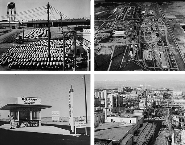
Courtesy of EPA

Courtesy of Library of Congress
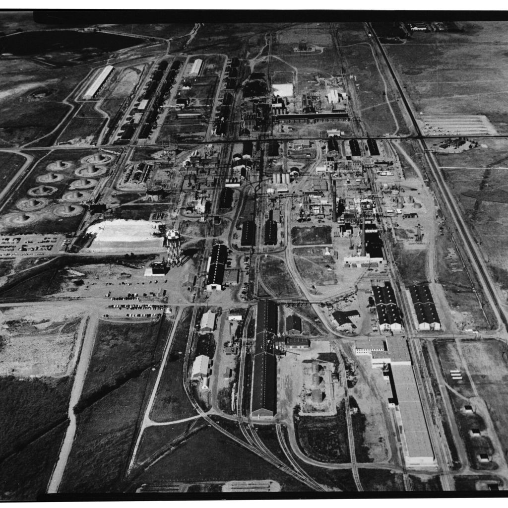
Courtesy of The Bulletin of Atomic Scientists
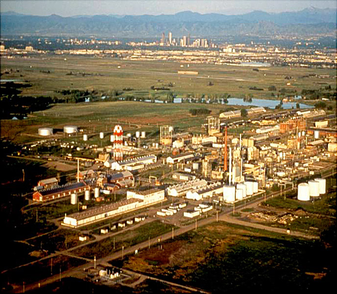
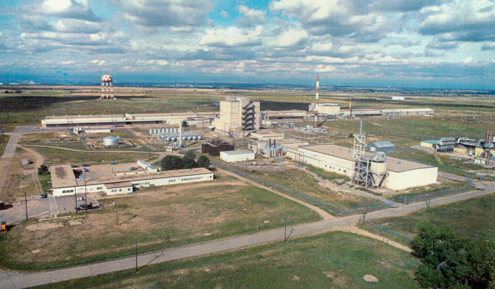
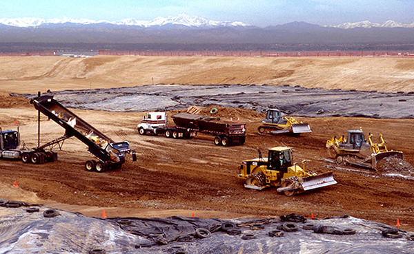

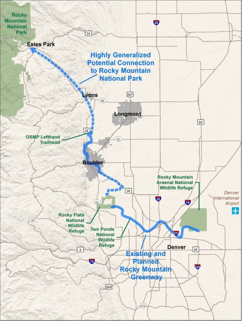
Courtesy of the Bulletin of the Atomic Scientists
American Service Members Hazardous Material Exposure
The Sergeant First Class (SFC) Heath Robinson Honoring our Promise to Address Comprehensive Toxics (PACT) Act.
Gulf War Illness
Burn Pit Exposure and Airway Disease
Burn Pit Exposure and Cancer Risk
Undersecretary of the Army apologizes for denying Purple Heart medals to troops exposed to mustard gas and sarin gas in Iraq because the rockets being disposed of were western made.
Agent Orange Effects on American Service Members and Vietnamese People
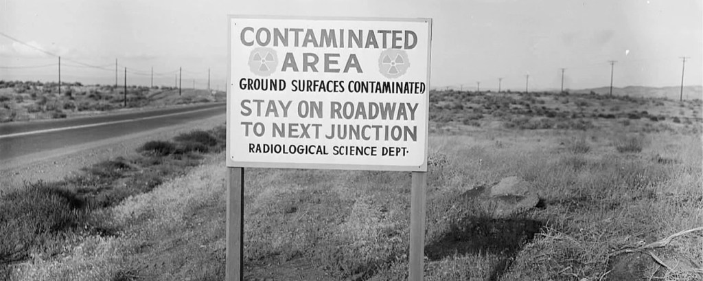
Hanford Nuclear Production Complex
The Most Contaminated Nuclear Waste Site in the Western Hemisphere
Richland, Washington
Located in the southeastern part of Washington State and covering 586 square miles of land, the Hanford complex was built on land of several ancestral Native American Tribes to include the Yakama Nation, Nez Pierce Tribe and Confederated Tribes of the Umatilla Indian Nation, with the the Wanapum being forced to relocate, despite the Government signing treaties with some Tribes and Bands (but not all) that the people have rights to hunt, fish and gather in all “usual and accustomed places”.
The Department of Energy’s Hanford site was used to produce plutonium for government use in national defense for 45 years, processing 100,000 tons of uranium to produce 75,000 tons of plutonium; 2/3rds of the nations stockpile. Now it sits with contaminated groundwater and soil from chemicals such as hexavalent chromium, nitrates and carbon tetrachloride as well as radioactive materials like uranium, strontium-90, iodine-129, technetium-99 and tritium.
It has groundwater contamination 260 – 330 feet below the surface with all those radioactive materials and hazardous chemicals, the water under 65 square miles is still contaminated beyond safe drinking water limits, in the 1980’s it was more than 80 square miles. Some of the contaminated groundwater reaches the Columbia River which runs through about 50 miles of the site and the river is said to have such a volume that it would render any contamination that reaches the river to be diluted down to barely detectable levels.
The initial nuclear reactors would pump water up from the Columbia River and after using it cool the nuclear fuel they would then release the contaminated water back into the Columbia River, later designs pumped the waste water into large trenches and ditches to filter through the soil before reaching the groundwater to flow down to the Columbia River, keeping the radioactive waste at the site to contaminate the soil and groundwater and less reaching the water directly, small victories people.
There was 440 billion gallons of wastewater created that was dumped or injected into the ground, ultimately leading to contaminating the groundwater, that would still end up heading towards the Columbia River, thanks guys. There were over 56 million gallons of radioactive waste stored in 177 underground single-shell tanks at the site and two of those tanks have been found to be actively leaking with a third likely leaking, calling it an “assumed leaker”, the waste from those first two tanks were moved to newer double-shell tanks.
The Department of Energy has been cleaning up the site since the site was added to the National Priorities List for cleanup in 1989 which is also when Washington State, the EPA and the Department of Energy entered into a Tri-Party Agreement for the clean-up and the estimate is between $300 and $640 billion to complete the cleanup based on a DOE 2022 estimate. Based on the DOE report of the contamination underneath the Hanford 324 building, it is worse than originally thought which also happens to sit just 1,000 feet from the Columbia River, The U.S. DOE had known about the leak for a decade but they found it to be deeper in the soil and wider in area than previously known. Every year the 1,076 wells around the site are sampled to determine the level of contamination that still exists in the groundwater.

Courtesy of Oregon Department of Energy
Hanford Environmental Dose
Reconstruction Project (HEDR)
The Hanford Thyroid Disease Study
The project was originally established by the DOE in 1987 and transferred to the Federal Center for Disease Control (CDC) in 1992 after the public was concerned about DOE’s involvement as a conflict of interest. The goal of the project was to understand how Hanford radiation releases affected the downwind population in particular, the project was completed in 1995.
It wasn’t until 1988, after formerly classified documents related to the production activities confirmed copious amounts of radioiodine were released into the area atmosphere for a 40 year period, because of that they launched a thyroid study to see if people living near the Hanford site from 1944-1957 were more susceptible to disease and thyroid cancers than the unexposed population. The study examined 5,199 people who were identified by birth records between the years of 1940-1946, to mothers who lived in one of the seven counties affected in Washington state. There was a draft released in 1999 that was regarded as highly suspect by much of the public and even some of the review panel scientists because the study discounted any evidence thyroid cancer or disease within the Hanford study population. Despite all of the statistical findings, many formers workers and residents including those who lived down wind of the plant, are extremely disappointed findings because so many are experiencing cancers, tumors, thyroid issues, autoimmune disorders and other ailments.
The Hanford Thyroid Disease Study (HTDS) researchers had some negative critique of the draft and sought an external third-party review and that review board external review board “re-evaluated the data and corrected errors in some of the dose estimates as well as characterizations of statistical certainty.” In June 2002, the final HTDS report announced “the findings do not prove that Hanford radiation had no effect on the health of the area population…if there is an increased risk of thyroid disease from exposure to Iodine-131, it is probably too small to observe…”
That period from 1944 – 1957 had the highest radiation dose originating from the air pathway at Hanford with iodine-131 being the largest airborne component with cerium-144, plutonium-239, ruthenium-103, ruthenium-106, and strontium-90 contributing in lower amounts. The highest radiation dose originating in the Columbia River was from 1950 – 1971, with Phosphorus-32 being the largest component of the Columbia River pathway with zinc-65, arsenic-76, neptunium-239, and sodium-24 present in lower amounts.
Hanford Superfund Site 100-Area
Hanford Superfund Site 200-Area
Hanford Superfund Site 300-Area
Hanford Superfund Site 1100-Area
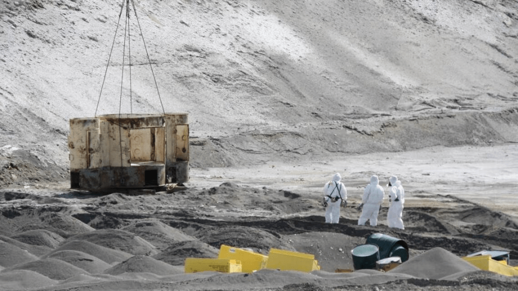
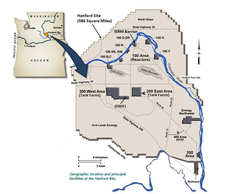
Courtesy of Oregon Department of Energy
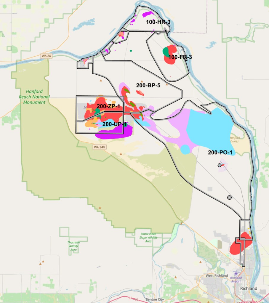
(Credit: U.S. Department of Energy / Office of Environmental Management)
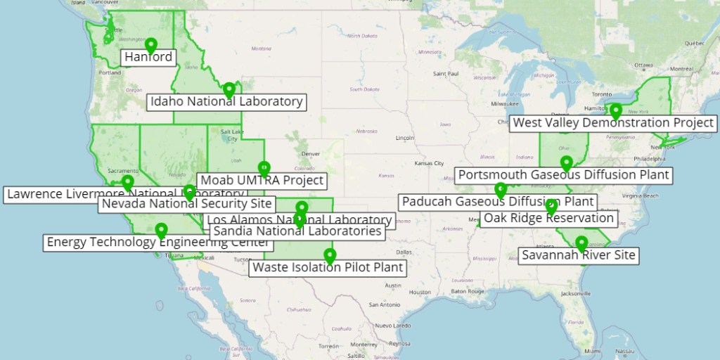
(Credit: U.S. Department of Energy / Office of Environmental Management)
The Green Run
A secret Air Force experiment at the Hanford nuclear production site in Washington, in order to test ways to detect a nuclear detention, with the single largest ever release of radioactive iodine-131 in December 1949, with approximately 8,000 curies worth of iodine-131 and other radioactive gases being released from Hanford’s Chemical Separations “T plant.”
A curie (Ci) is a unit used to measure radioactivity, specifically the rate of radioactive decay. One curie is defined as 3.7 x 10^10 (37 billion) radioactive disintegrations per second, according to the Center for Domestic Preparedness
Ultimately they released twice as much iodine-131 as they had predicted in the experiment, which is still much less than the total amount released by the Hanford plant while it was in operation, a total of 739,000 curies worth released from 1944-1972 but it was still damaging. Hanford’s environmental monitoring staff showed vegetation contamination readings at 600 times the tolerable amount in Kennewick, Washington, with the winds and the rain the scientists lost track of the radioactive release and it rained down significant concentrations of radioactive materials on Spokane and Walla Walla.
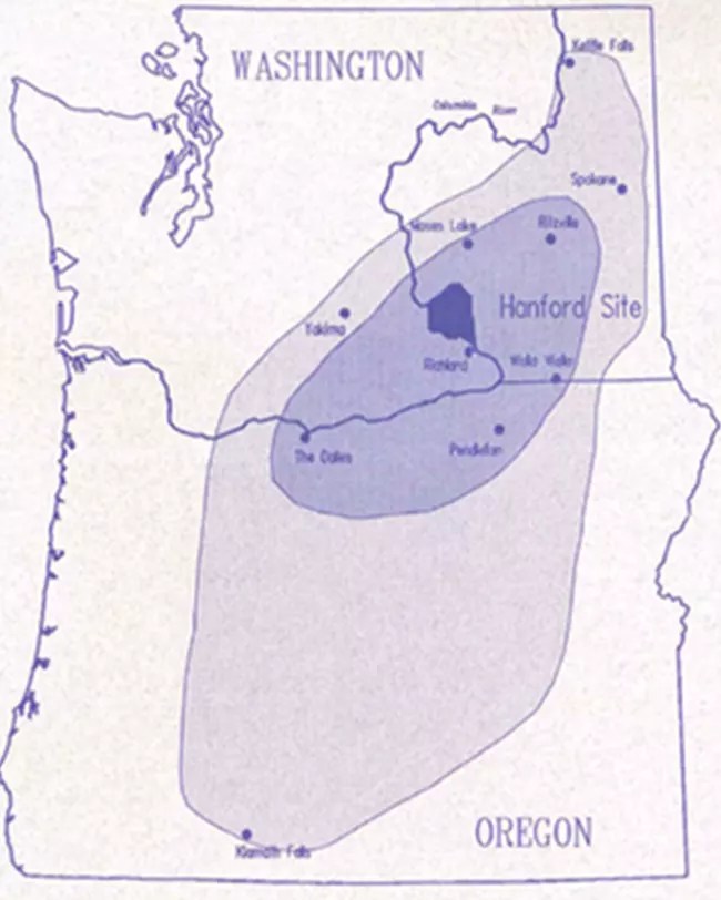
Source National Park Service
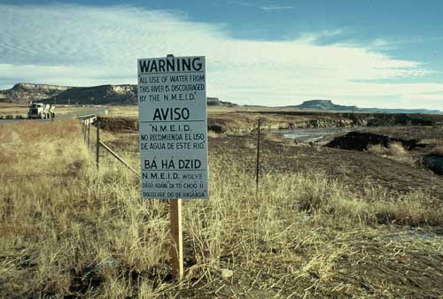
Church Rock, New Mexico
Uranium Mill Spill
The largest radioactive spill in U.S. history
A Health and Environmental Assessment
With the largest underground uranium mine in the United States came the annual production of two million pounds of uranium oxide, while being in operation from the 1940s to the mid 1980s as the United States was stockpiling nuclear weapons, with federal officials estimating private companies mined 4 million tons of uranium ore from mines on Navajo reservation. The United Nuclear Corporation was licensed to operate the Church Rock Mill by the New Mexico Environmental Improvement Division less than 10 years after mining started, the area around the mill and disposal complex were used primarily for livestock grazing, the mine also employed over 200 Navajo workers from the local community.
The waste, wet sand and mill liquids, from the mining was then pumped and dumped in three lined lagoons that were fortified by a 50-75 foot high earthen impoundment, the dam was built on geographically unsound land according to United Nuclear Corporations own consultant as well as state and federal agencies. The United Nuclear Corporation which began to operate the county’s largest uranium mine in 1968, state and federal agencies were aware of this. The soil under the dam was susceptible to extreme settling that was likely to cause cracking structural failure, large cracks were found in the dam by 1977, with the telling signs of disintegrating infrastructure not being reported. The waste was from the mining process that converted mined uranium into yellow slurry, known as yellow cake.
Sadly on July 16th, 1979 the dam had breached with 1,100 tons of uranium waste and 94 million gallons of radioactive mill waste which then seeped into the Puerco River, which flowed through nearby communities, with scientists estimating that the amount of radiation released was larger than the amount released just 4 months earlier at Three Mile Island. Following shortly after the dam break there was water, soil and air samples taken that showed radioactivity had increased significantly, with levels falling that autumn with the help of rainfall. The amount of water that as released in the dam break led to backed up sewers, affected two aquifers, there were pools left along the river and moved contaminants 130 km/ 80 miles downstream to a point near Navajo, Arizona.
Those who relied on the river as a watering source for livestock were the residents surrounding the mill, almost entirely Navajos, they have since suffered severe health problems due to substantial increases in radioactivity found in the soil, water and air. There were sheep and goats that had consumed the tainted water from the dam break and they were found to have elevated radiation levels in their tissues, individuals were warned against using the contaminated water.
Eventually the United Nuclear Corporation had dug new drinking wells and removed 3,500 tons of sediment from the Puerco River but that only amounts to 1% of the estimated total spilled material. The Navajo Tribal Councils Emergency Services Coordinating Committee had requested the Governor of New Mexico to declare the region as a federal disaster area, the governor denied the request and less than 5 months after the spill the Nuclear Regulatory Commission permitted United Nuclear Corporation to resume operations at the Church Rock mine, with the increased activity worsening conditions in the area leading to extensive groundwater contamination.
The mine was eventually abandoned in 1982 with it being added to the National Priorities List in 1983. The United Nuclear Corporation removed mine waste in 1991, taking it from the Old Church Rock Mine ponds, transporting the waste to the Northeast Church Rock Mill.
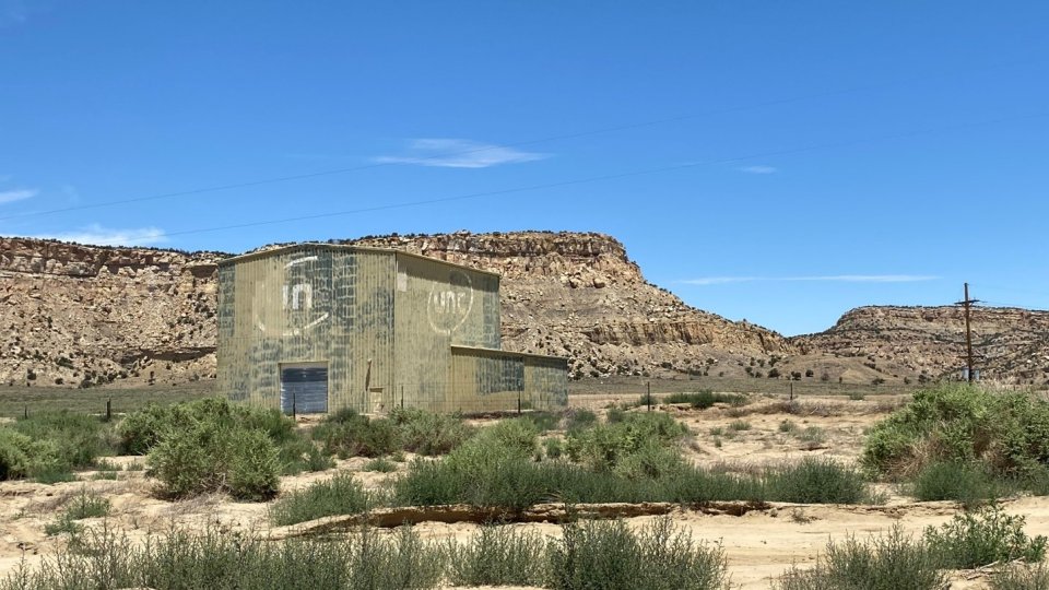
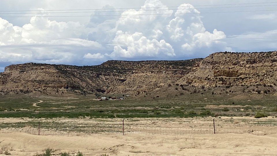
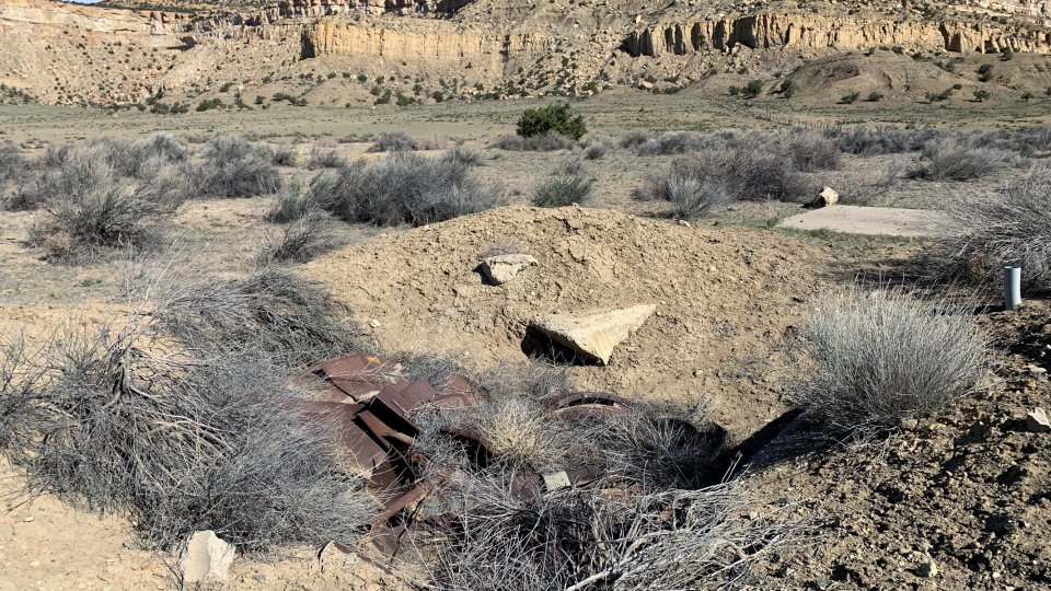
Sequoyah Fuels Corporation
Gore, Oklahoma
The site was a former uranium conversion facility that was purifying and converting yellowcake (concentrated uranium ore) to uranium hexachloride gas (UF6) for privately owned nuclear power plants from 1970-1992, a year later in 1993 the Sequoyah Fuels Corporation ended operations. With an 85 acre Process Area for the operations on site, the remainder of the site was used to manage storm water and store byproduct materials.
What started as a leak in an overfilled 14-ton UF6 cylinder, would result in a rupture that killed one person, James Harrison, who was in the path of a plume consisting of uranylfluoride and hydrofluoric acid headed towards the scrubber, inhaling the hydroflouric acid leaving him with acute respiratory injuries that led to his death; of the 42 onsite workers, 37 of them were hospitalized. The rupture was the result of the scale not being properly calibrated prior to filling the tank as well as the workers being told to go against company policy and to liquify the UF6 in a steam chest. Even though the rupture released material it didn’t compare to the chronic on-site releases, some of which were substantial and the bulk of the contamination coming from the leakage from storage ponds.
The land has been identified to have uranium and thorium contamination of the soil and sub soils, the groundwater is also contaminated with uranium, thorium and metals, contamination spread over 600 acres of land. The property was sold in 1988 to General Atomics and another acute release happened in 1992, a year later they shut down for good and began a long de-comissioning process to address on-site contamination, most of which was from normal operation.
From the Fort Smith Times Record;
“The Cherokee Nation has been in and out of court with Sequoyah Fuels since 2004, and now this material is no longer a ticking time bomb on the banks of the Arkansas River, one of our most precious natural resources,” Cherokee Nation Secretary of Natural Resources Sara Hill says. “Decommissioning this plant was never enough to satisfy our goals for a clean and safe environment. Removal of this highly contaminated waste was our goal, and we’re pleased that goal has finally been achieved.”
There was a settlement agreement in 2004 with the Cherokee Nation, the state of Oklahoma and Sequoyah Fuels Corporation that the highest risk waste be removed from the site, in 2016 the company announced they wanted to bury the waste on site, thankfully a judge forced them to comply with the original agreement. The cleanup costs were more than $4 million, 3 million of that came from the company pledge towards moving the material off-site after the State of Oklahoma and the Cherokee Nation sued the company, the state and the tribe paid the rest of the costs to move the material offsite and in late 2018 that last 511 truckloads of nuclear waste left the site. The Cherokee Nation and the Oklahoma attorney general’s office spent 18 months working to make sure the 10,000 tons of radioactive material were removed from the site for off-site disposal, where it’ll be taken to Utah to be recycled and reused.
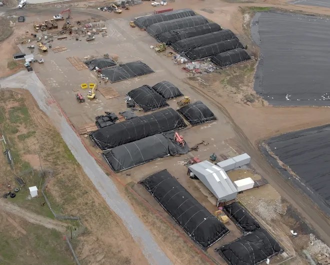
{Photo courtesy of Osiris, Voices of the Cherokee People} Fort Smith Times Record
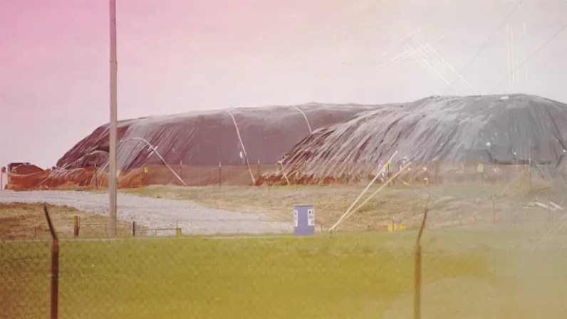
Courtesy of United for Oklahoma
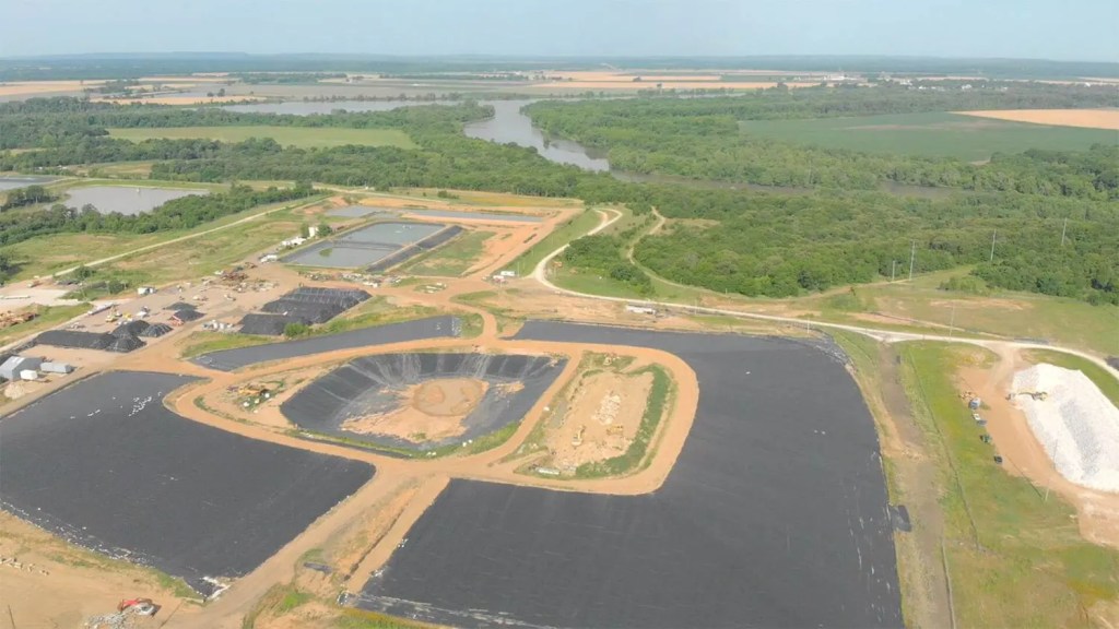
Rocky Flats Plant
Golden, Colorado
The 6,240 acre site is owned by the Department of Energy and was used to make triggers for nuclear weapons from 1951 until 1992, under the control of the U.S. Atomic Energy Commission, the triggers were plutonium fission cores made from radioactive and hazardous materials. Between the manufacturing process and the accidental fires, spills and waste management practices left the soil, sediment, groundwater and surface water contaminated with hazardous chemicals and radioactive materials; the greatest contamination of hazards is located within the 385 acre industrialized area in the center of the property, where most of the 800 buildings were located; with approximately 150 permanent buildings, 90 trailers, temporary structures, sheds, tanks and annex’s to larger buildings. There was a spot known as the protected area in the northern part of the industrial site, it was a heavily fenced and guarded complex of plutonium production facilities.
There were two Operable Units at the site, 1,308 acre OU1 was the industrial center of the site which had 384 acres where most of the weapons manufacturing occurred and where the plutonium, uranium and americium contamination were at their highest. OU2 was 4,883 acres included a buffer zone. There’s a hidden area behind gates locked by the Department of Energy, 1,309 acres of mostly cleared land called the Central Operable Unit which was for the testing and treatment of the remaining immovable contamination. Congress bought some more land around the site as a buffer to prevent the public access after researchers discovered traces of plutonium and elevated levels of radioactive tritium in local rivers in 1972, more land was bought to expand the existing buffer zones by Congress after plutonium was discovered in soils beyond the original buffer by scientists.
What seemed like an expected FBI and EPA raid on the facility on June 6th 1989 went down without a hitch with over 75 investigators, 30 vehicles and 2 EPA mobile environmental crime labs showing up; even though security at the site were armed, ready and willing to open fire at any security breach with signs stating “Deadly force is authorized”, the FBI and EPA were there for alleged environmental crimes. The grand jury met once a week every month, for two years, listening to the testimony of 110 witnesses and reviewing 760 boxes of documents; on May 18th, 1991 the grand jury voted to indict Rockwell, 5 Rockwell employees as well as 3 DOE employees after finding their actions resulted in over 400 environmental violations, the government couldn’t let that be known to the public so the U.S. Attorney Mike Norton arraigned a plea deal. Rockwell pleaded guilty to 10 environmental crimes (5 felonies and 5 misdemeanors) and paid an $18.5 million fine, less than 1% of the company’s annual sales, because of the plea deal it protected Rockwell and all individuals involved from prosecution in the future and kept all court records sealed. The DOE and its predecessor, the Atomic Energy Commission, had argued that on the needs of national security Rocky Flats was exempt from environmental laws; EG&G, assumed management in September 1989 of the site.
Prior to the raid which was called “Operation Desert Glow”, the FBI was doing night flyovers and in December 1988 established the company was using a banned incinerator to dispose of waste, the company was also improperly spraying waste water which allowed runoff to reach nearby streams, that’s on top of the “pondcrete” they were creating by pouring cement with semi-solid hazardous and radioactive waste out of solar ponds into 15 cubic-feet size plastic lined cardboard boxes and frequently the concrete wouldn’t harden and leaked out of its boxes. Rockwell International was charged by the US justice department with violations of the Resource Conservation and Recovery Act as well as the Clean Water Act in 1992, the company had allowed polychlorinated biphenyls (PCBs), chromic acid, beryllium, and radionuclide emissions—all chemicals with serious compound implications for human and environmental health—to be released into the environment.
Building 771 was called “the Most Dangerous Room in America”, it was one of the first major buildings to be constructed and placed into operations, the rooms would become so contaminated that their radiation couldn’t be measured by Rocky Flats Geiger counters. The building was used for the production of plutonium weapons components and recovering plutonium from recycled materials. The recovery of plutonium involved purification of plutonium scraps and residues so that it can be recycled back into the weapons component manufacturing process. There were 13 rooms called infinity rooms because of the warning that the rooms contained “infinite” contamination. The 1957 fire was in this building, it started in a can of plutonium residue, spreading to the glovebox exhaust filters and the second story of the building. With flammable vapors collecting in the main exhaust duct that exploded, it led to plutonium contamination spreading to much of the building. Even though there were no human casualties, the explosion may have led to the release of plutonium outside the building.
At the 903 pad, which was originally an open field, it would be used to store over five thousand 55 gallon drums of plutonium-contaminated waste oil and solvents, these barrels would corrode and leak after being left exposed outdoors for years, spreading contamination to the soil and being carried off-site by the wind. They even stored In 1969 there was an asphalt cap placed over the area to contain the contaminants. They even had 62 pounds (28 kilograms) of plutonium that was found in the ventilation and piping of the building, enough for 6 or 7 bombs. That’s not even mentioning the 6,000 pounds of missing uranium, missing unaccounted for plutonium (MUF), which according to the the Department of Energy was most likely administrative errors
The EPA investigation and cleanup from 1990 til 2006 saw the closing, cleaning, tearing down and removing more than 800 building, draining 30,000 liters of plutonium solution, taking away more than 600,000 cubic meters of low-level radioactive waste, stabilizing and packaging 100 tons of high-content plutonium residue for removal. The cleanup didn’t remove all of the contamination in the center part of the industrial area, the long term plan for the site included fence, signs, new rules about land use and monitoring. There were 21 tons of weapons grade material removed from the site, with another 1.3 million cubic meters of waste, including contaminated soil. They constructed 4 ground-water treatment systems and treated more than 16 million gallons of water.
All of the buildings originally at the site were torn down and removed, but there’s still some contamination that remains in core production areas, settling ponds and two landfills. The EPA decided in 2006 that the site didn’t need any further cleanup, levels of contamination are generally below legal standards and studies have shown that this contamination is not a threat to the environment or human health, the site was regulatory closed the same year.
There were two major plutonium fires at the plant, 1957 & 1969, both were from plutonium shavings spontaneously combusting in a glove box where the plutonium was worked by employees, after the 1957 fire it was recommended to install suppression systems in the glove boxes. They weren’t added and another fire happened in 1969, although it was less severe contamination than the first fire because the HEPA filters in the exhaust system did not burn through. On top of the plutonium fires there was a rash of leaking barrels of waste oil and solvents contaminated with plutonium and uranium that were located in an outdoor storage at the 903 area from 1964-1968,
The land was set aside in 2007 to be used as a wildlife refuge and was transferred to U.S. Fish and Wildlife, the land that used to be a buffer zone for the site is now Rocky Flats National Wildlife Refuge. The area where the refuge is now was never used in production and the EPA did a did a lot of air and soil sample of the refuge during the planning and cleanup, the test confirmed that public could use the area safely without additional cleanup, the Rocky Flats National Wildlife Refuge is now safe for all uses.
Despite those claims, there’s been three municipal governments so far that have expressed concern over residual contamination, starting in 2016 a town north of the site, Superior, voted to withdraw from the Rocky Mountain Greenway, a Federal Lands Access Program grant and project. In 2020 the city and county of Broomfield did the same thing, the vote to approve a resolution for the withdrawal from the greenway was unanimous. There was a consultant hired by the Broomfield city council to conduct soil sampling along the proposed greenway, there was some concern expressed in the resolution over the high levels of plutonium detected in the soil. The city stated, after the resolution, that it wouldn’t contribute the $105,000 that was originally going to the Greenway project and they wouldn’t allow construction work related to the Greenway project on Broomfield property.
There was another post-cleanup proposal-the Jackson Parkway Highway Authority- which is described on it’s website as a “privately-funded publicly-owned regional toll road”, that was also opposed by the city of Broomfield. There would have been a road proposed to pass just outside the wildlife refuge, which happened to used to be the eastern boundary of the former plutonium facility, problem is they never had plans to do any sampling nearby. After the city of Broomfield and the citizens advisory board recommended doing sampling before any construction began, there was finally some sampling starting by the authority, in September 2019 they reported a sample containing 264 picocuries of plutonium per gram which was much higher than the maximum limit of 50 picocuries per gram for surface contamination within the former industrial zone ( picocurie is one trillionth of a curie, a measure of radioactivity).
Plutonium-239 and Americium-241 Contamination in the Denver Area
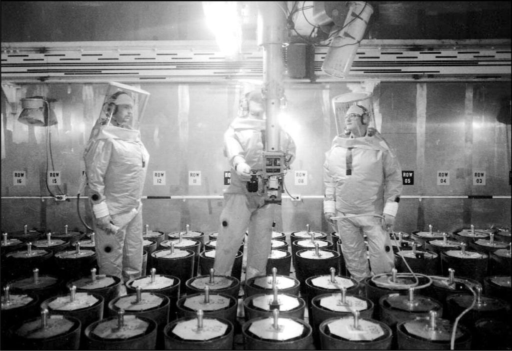
Courtesy of the Bulletin of Atomic Scientists

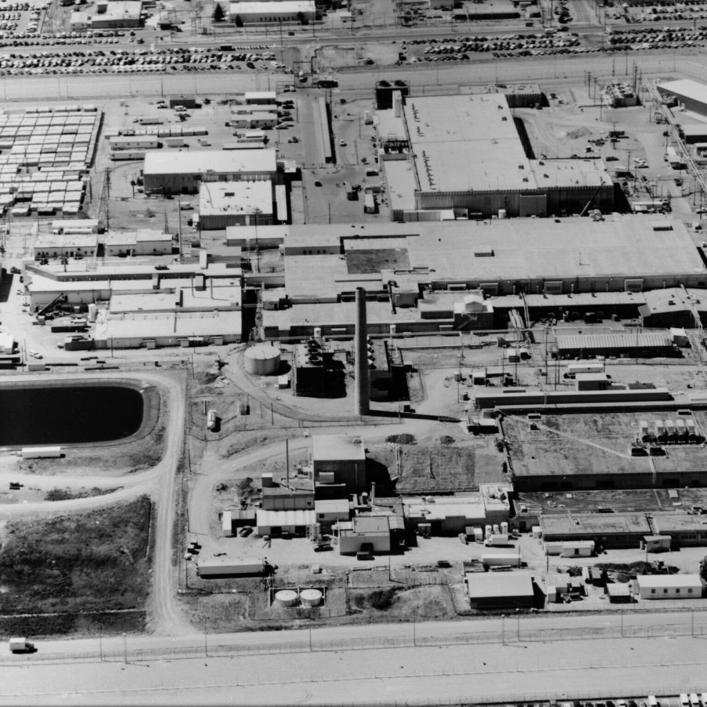
Courtesy of The Bulletin of Atomic Scientists
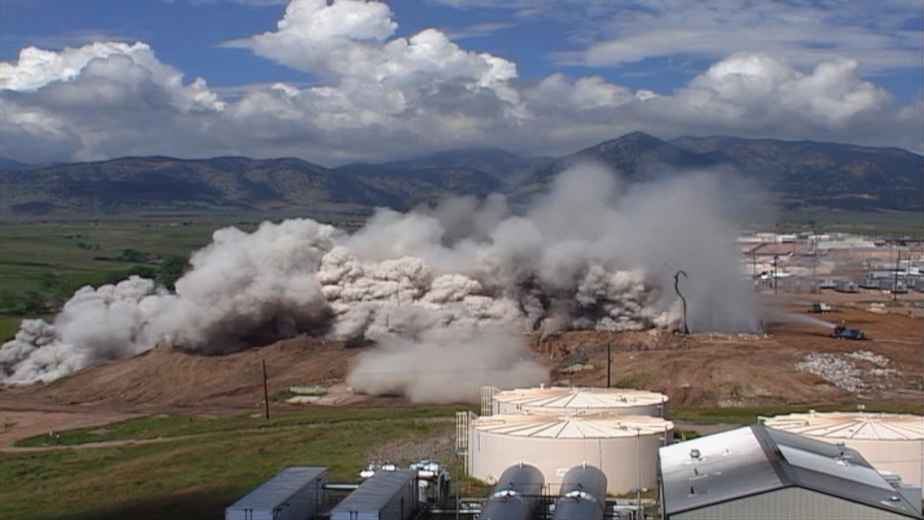
U.S. DOE / Courtesy Of Jeff Gipe / Half-Life Of Memory

Courtesy of The Bulletin of Atomic Scientists
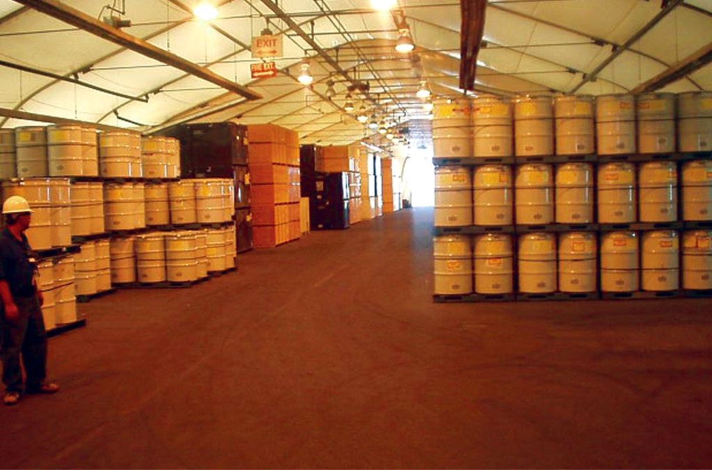
US Government- Courtesy of The Bulletin of Academic Scientists

(Mike Sweeney, Special to The Colorado Sun)
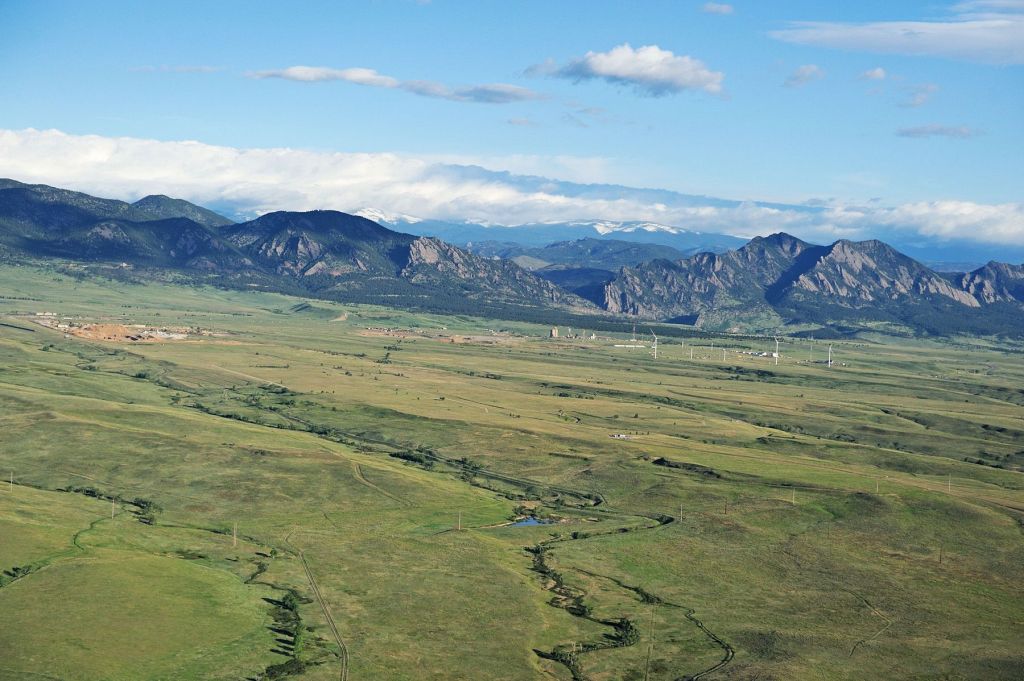
Energy Department- Courtesy The Bulletin of Atomic Scientists
Santa Susana Field Laboratory
Simi Valley, California
Established in the 1940s for rocket and nuclear reactor experimentation for “America’s Race to Space”, the Santa Susana Field Laboratory (SSFL) is joint owned by the U.S. government and The Boeing Co. (Boeing). They had rocket engine testing beginning in 1947 for the U.S. government and they would end up conducting 17,000 engine rockets tests, many with very toxic fuels, which happened to produce massive plumes of airborne contaminants that extended substantial distances. Nuclear testing ended in 1988 and rocket engine testing ceased in 2006.
Boeing bought almost all of the site from Rockwell International in the 1990s, which was then called the Rocketdyne facility, it wasn’t just the land they acquired but also inherited the liability for the cleanup. On top of the hazardous rocket fuels, there were thousands of tests that involved flushing the rocket engines after firing with trichloroethylene (TCE), a volatile organic compound that’s very hazardous. It isn’t just the rocket fuel and TCE that are of concern, despite requirements to the contrary, there were open “burn pits” used to dispose of radioactive and toxic chemical waste, leaving this site to be one of California’s most toxic sites. It’s estimated that 500,000 gallons of a highly toxic solvent, Trichloroethylene (TCE), was lost into the soil and groundwater due to inadequate and faulty catch ponds. Sodium was disposed of in burn pits, putting a sodium contaminated part in water so it would burn as sodium is reactive to water, burning radioactive parts this way would have carried radiation into the air.
There are 4 operable units that make up the 2,849 acre site, Boeing owns OU’s number 1 (671 acres),3 (114 acres) and 4 (290 acres) while the U.S. government owned OU number 2 (410 acres) and NASA managed it; Boeing operates a 90 acre ETEC section in OU number 4 as a contractor for the Department of Energy (DOE). At the Energy Technology Engineering Center (ETEC) site, Boeing operated 10 nuclear reactors and related facilities from 1949 – 1988 that resulted in radiological and chemical contamination, with all fuel elements and nuclear reactors removed from the SSFL.
Gov. Arnold Shwarzenegger signed California Senate Bill 990 into law in 2007, which would have required the responsible parties to cleanup their parts of the Field Lab to a level suitable for recreational or agricultural use, whichever was more stringent. However a federal court struck down the law after Boeing challenged its validity on the grounds that it singled out one site in California for stringent action; basically saying they were way worse than any other site in the country so its not fair they have to clean it up.
The initial agreement, the 2007 Consent Order, was between the California Department of Toxic Substances Control (DTSC), NASA, Boeing and the DOE and defined the requirements for investigating the contaminated groundwater and soil as well as to implement the cleanup at SSFL. There was a second Administrative Orders of Consent with California signed in 2010 by NASA and DOE, which included a historic requirement to clean radiation in soil to background levels. There are several key components of the agreements; they are legally binding which means no parties cannot unilaterally choose not to comply with any part of them, they also give California authority over the cleanup standards and method, as well as the deadline for full soil cleanup and implementation of the groundwater remedy was 2017, even though the cleanup has barely begun.
There was a study that the 2018 Woolsey fire, which had begun on the lab site, could spread site contaminants to distant but widely spaced locations, that fire quickly burnt 80% of the SSFL property. The California’s Department of Toxic Substances and the LA County of Public health said the radiation levels were no higher than background levels in the fire damaged areas. A group of concerned scientists from Fairewinds Energy Education who made their own measurements and found than more than 10% off their samples had elevated levels of radioactive materials that included uranium, radium-227, and thorium.

The Department of Energy, NASA and the State of California signed subsequent, but separate Administrative Orders of Consent (AOC) in 2010 to fully cleanup their sections to background level, which meant any contamination they created would need to be cleaned up. Boeing did not sign an Order of Consent, the cleanup they were responsible for was bound by a 2007 State of California Consent Order which gives the DTSC the authority to set the standards for the cleanup of the portion of the site that Boeing was in control of; which as of the time of this article had not bet set yet. With Boeing telling NBC4 “the cleanup will be based on established science and follow the regulatory process with transparency and full community participation.” Further, the company says that in the future the site will only be used as “undeveloped open space.”
Boeings cleanup work at the site include removing of treating 45,000 cubic yards of soil, they’ve drilled 260 groundwater monitoring and extraction wells, dismantled more than 300 structures and analyzed 38,000 soil and groundwater samples. They also installed a state-of-the-art groundwater treatment system. The California DTSC hasn’t been stringent enough though, in 2021 they wrote to Boeing to enter into a “confidential mediation”. After the conclusion of the mediation, the DTSC and Boeing agreed to redefine the cleanup standards, which the Natural Resources Defense Council (NRDC) and its colleagues believe this will weaken what will ultimately be the cleanup requirements at the site.
There were multiple fires and accidents across SSFL that spread radioactivity through the site; the AE6 reactor experienced a release of fission glasses in 1959, the SNAP6ER experimental reactor experienced 80% damage to its fuel in 1964 and the SNAP8 developmental reactor experienced damage to a third of its fuel in 1969. Even the hot lab experienced a number of fires; the hot lab was used for decladding (process of removing the protective outer layer) and disassembling irradiated nuclear fuel shipped in from around the national nuclear complex operated by the Atomic Energy Commission/Department of Energy (DOE) for the initial step in reprocessing.
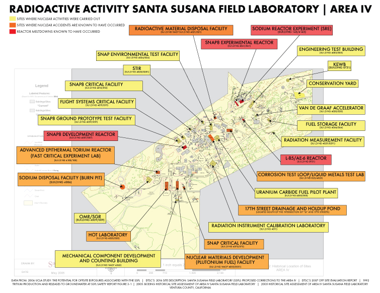
At the formerly named Rocketdyne, there was a chemical study done in 1999 which showed workers who had high hydrazine exposure compared to other workers were twice as likely to die from lung and other cancers. There was at Federally funded epidemiological study done in 2007 by the University of Michigan which determined that was a direct correlation between a 60% increased cancer incidence and how close residents lived to the SSFL.
UCLA also conducted a Rocketdyne Workers Radiation Study in 1997, studying 4,563 employees and Hal Morganstern, director of the UCLA study wrote “All available evidence from this study indicates that occupational exposure to ionizing radiation among nuclear workers at Rocketdyne/AI has increased the risk of dying from cancers,” “We found the effect of radiation exposure was six to eight times greater in our study than extrapolated from the results of the A-bomb survivors study.”
Dr. Morgenstern in 2007 conducted a federally funded study, “Cancer Incidence in the Community Surrounding the Rocketdyne Facility in Southern California,” which concluded that “There is no direct evidence from this investigation, however, that these observed associations reflect the effects of environmental exposures originating at SSFL.“
The California Environmental Health Tracking Program in 2012 determined there was 10-20% higher invasive breast cancer rates in East Ventura County/West San Fernando Valley. Boeing Corporation had a draft RCRA Facility Investigative Data Summary in 2015 that found 96 out of 100 would get cancer if they ate produce grown at the SSFL and lived on parts of the Boeing’s property.
The California EPA (CalEPA) announced a comprehensive framework in May 2022 that involves two agencies within the CalEPA; the Department of Toxic Substances Control (DTSC) and the Los Angeles Regional Water Quality Control Board (Los Angeles Water Board). The standards that were set with the framework ensuring that Boeing cleans up the radionuclides in the soil of the area they were responsible for, to “background” levels that would be found locally without industrial activity. They would also be required to cleanup chemical contamination to a health protective cleanup standard that could be as strict as the “Resident with a garden” standard where someone could live on the site and eat produce grown on the site, which members of the surrounding community have advocated for. Once they finish the cleanup the Boeing would need to make sure stormwater runoff from their areas will not be polluted.
The California DTSC issued an Environmental Impact Report in 2023 stating the cleanup would take 15 years, with activists saying that plan would leave the majority of the contamination in place. According to the California Environmental Protection Agency, Boeing’s cleanup costs are expected to cost hundreds of millions of dollars, with NASA estimating it would cost at least $200 million for the cleanup of its portion of the field. Removing the site to a less stringent recreational use would cost from $25 to $76 million, according to NASA who seems to prefer doing less cleanup and spending less money overall, letting a portion of the waste just to sit for future generations to deal with.
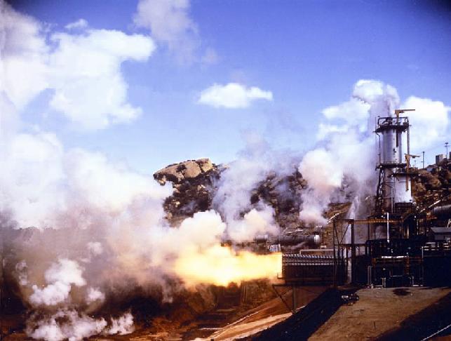
Sodium Reactor Experiment
Elemental Sodium should not be confused with table salt, sodium chloride, elemental sodium is a nasty element, burning in contact with air and exploding in contact with water. During power run 14 in 1959, the Sodium Reator Experiment had some extensive fuel damage with 13 of 43 fuel elements overheating when the cooling flow provided by liquid sodium was partially or fully blocked by a leak of tetralin by leaks from pump seals, into the primary sodium loop during prior power runs.
The reactor was showing skyrocketing temperatures on Monday, July 13th, which would indicate a runaway reaction, the workers plunged control rods into the core in an attempt to stop the reaction; that didn’t work and they shut it down manually. They also released radioactive gasses into the air to relieve pressure and prevent an explosion. The workers then turned the reactor back on with no idea a partial meltdown was occurring. Ultimately with the release of radioactive gasses in an attempt to prevent an explosion, it could have been as much as 13,000 curies of iodine-131 and 2600 curies of cesium-137; compared to the Three Mile Island release of 17 curies of iodine-131 and no cesium released.
The reactor was off and on again for the next 2 weeks, operating in fits and starts; repaired in 1960 and a second fuel loading inserted, it then continued to operate until February 1964 when it was shut down permanently. Six weeks after the Sodium Reactor Experiment, the Atomic Energy Commission issues a press release saying it has inspected the SRE, evaluated the situation and “no release of radioactive materials to the plant or its environs occurred and operating personnel were not exposed to harmful conditions.” Even though they knew otherwise because there twas an internal memo issued by R.K. Owen, Health Physics Department at the lab who sent it to R.E. Durand of Atomics International, which discusses an air sample that tested radiation of 300 times the maximum permissible level, but the public wouldn’t find out til 20 years later.
UCLA students of Professor Hirsch in 1979 had wondered why Santa Susana closed so quietly when there was so much promised with the nuclear power initiative, their search lead them to a dusty library annex with material donated by Chauncey Starr, UCLA’s Dean of Engineering. He had worked with J. Robert Oppenheimer on the Manhattan Project and after the war joined Rockwell as vice president, he was also president of Atomics International for 20 years. That material is where they discovered documents and photos of damaged fuel roads at Santa Susana related to the experiment, the student’s findings were published in a pamphlet by an anti-war group, Another Mother of Peace, but didn’t get any attention. The Committee to Bridge the Gap was founded by Professor Hirsch and his next report was picked up by the local NBC affiliate, becoming part of their in-depth and comprehensive America’s Nuclear Secret report, which began with them airing a week of exposé’s about the disaster.
California holds Boeing accountable for cleanup at toxic Santa Susana Field Laboratory
CALIFORNIA DEPARTMENT OF TOXIC SUBSTANCES CONTROL’S SANTA SUSANA FIELD LABORATORY CLEANUP PROJECT
The Santa Susana Field Laboratory
(SSFL) Advisory Panel
DTSC Releases Final Environmental Impact Report for Santa Susana Field Laboratory
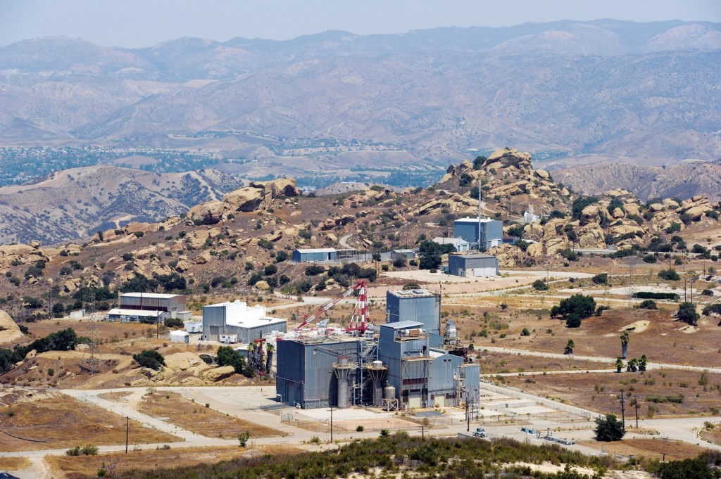
Acorn file photo -Courtesy of Simi Valley Acorn
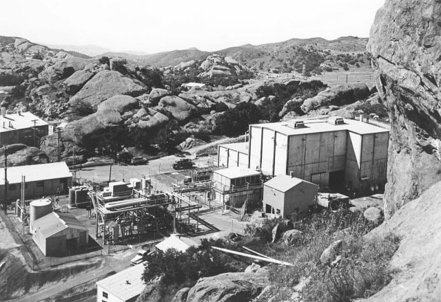

Courtesy of NASA
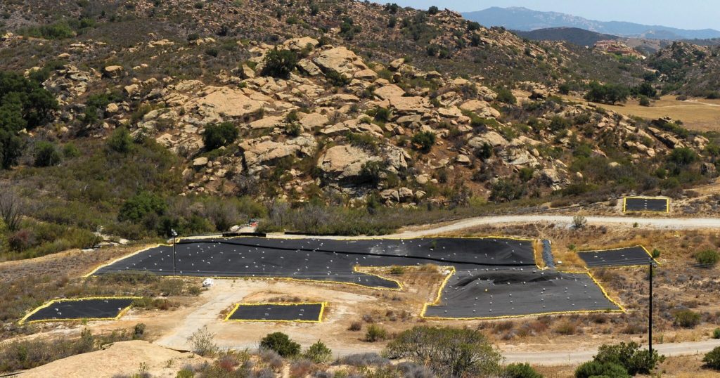
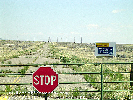
Courtesy RadiationWorks
SL-1 Reactor Meltdown
Idaho Falls, Idaho
The SL-1 reactor was US Army research facility located at Idaho Falls, now known as Idaho National Laboratory. The site has 890 square-miles, was established in 1949 by the Atomic Energy Commission and has been home to 52 nuclear reactors through its life; the largest concentration in the world. At its peak in the early 1960’s there were 26 active reactors, since 1996 only 3 remained online.
The SL-1 reactor (Stationary Low-Power Reactor Number 1) was designed to provide heat and electricity for remote DEW line (Defense Early Warning system) radar sites in Alaska and Greenland, this was to provide early warning of attack by ICBM’s (Intercontinental Ballistic Missiles) or Russian aircraft. The Secretary of Defense in February of 1954 authorized the US Army to develop small nuclear reactors, The US Army’s Stationary Low Power Reactor Number One (SL-1) was an experiment to provide power for remote radio stations and austere location signals and began operating on August 11th, 1958. It wasn’t as cool sounding as the Air Force’s plan for a nuclear powered bomber or the Navy designing nuclear power plants for what would become nuclear powered submarines. The reactors were designed to be lightweight, small, capable of operating for 3 years without refueling while being easy to maintain, designed to operate at a maximum power of 3 megawatts.
The reactor was shutdown for Christmas break on December 23rd, 1960 by the contractor Combustion Engineering, they operated the reactor for the US Army. In going through the shutdown process they fully inserted the control rod, the control rod controls the rate of reaction in the core, they then disconnected it from its drive mechanism.
On January 3rd, 1961, a three man crew arrived at the reactor in the evening to reconnect the drive mechanism for the main control rod in preparation for restarting the reactor. They had to move the control rod out about 4 inches (10 cm) in order to reconnect the drive system, for reasons that were never determined, they moved the rod about 20 inches (51cm) which led to a power surge, the reactor then produced about 20,000 megawatts of power (20 gigawatts) in 4 milliseconds. The core overheated in milliseconds, the steam explosion that followed sent the control rod upward and disrupted the reactor care; killing all three of the people nearby. An investigation determined the reactor design was poor, with one control rod controlling 80% of the activity in the core, with the cause of the accident being the improper withdrawal of the main control rod.
Even though there was no containment structure for the reactor like ones on commercial power reactors, the reactor was housed in a steel cylinder that was 1/4 of an inch thick (0.63 cm) and that held most of the radiation release. Downwind of the building, it’s radioactivity reached 50 times background levels near the plant, thankfully of how remote the site was located, no other humans nearby were adversely affected by the release. The accident was classified as a level 4 on the International Nuclear Event Scale, which goes from 0-7, with 4 being said to be “an accident with local consequences”, that scale is used by International Atomic Energy Agency (IAEA) since 1990. The radioactivity inside the reactor building was so high that when the rescue team went in to assess the situation and rescue victims, they could only be in there for one minute in whole body protective clothing. The accident released about 80 curies (3.0 TBq) of Iodine-131, which wasn’t considered bad because of the remote location, there was about 1,100 curies (41 TBq) of fission products released into the atmosphere.
When the pressure got too high the water hammer (water pressure surge) blasted upwards, sending the entire reactor vessel upward at 27 feet per second, a later investigation found that the vessel which weighed 26,000 pounds (12,000 kg) and had jumped 9 feet 1 inch (2.77m), with part of it hitting the ceiling of the reactor building. With the intense pressure of the reaction the spray of water and steam knocked down two of the three men in the room, killing one and injuring the other. The third man was less fortunate, he was standing over the reactor when the No. 7 shield plug from the reactor vessel impaled him through the groin and exited his shoulder, pinning him to the ceiling.
The three men who passed away were Army Specialists Richard Leroy McKinley (27 years old) and John A. Byrnes (22 years old), and Navy Seabee Construction Electrician First Class Richard C. Leg (26 years old). Now McKinleys grave sits untouched and radioactive, at Arlington National Cemetery, Byrnes is buried in Whitesboro, New York and Legg is buried in Kingston, Michigan. All three graves require AEC permission to disturb and all three are buried in lead lined caskets.
General Electric was the cleanup crew, in 1961 they constructed a burial ground where they sealed 99,000 cubic feet of contaminated material underground, it was located near the original reactor site. Between the explosion and the cleanup effort, it’s estimated that 790 people were exposed to harmful doses of radiation. Starting in 1999, nuclear waste was starting to be transferred to the Waste Isolation Pilot Plant (WIPP) in New Mexico

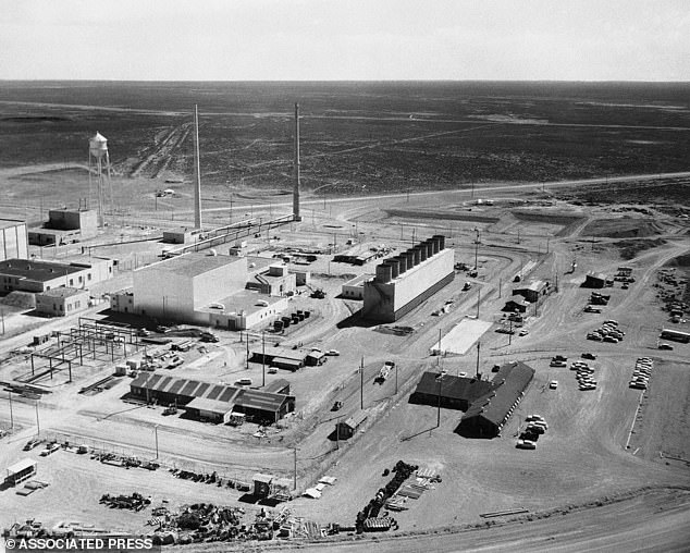
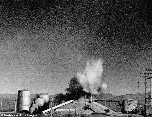
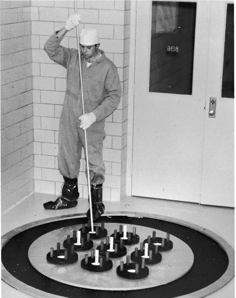
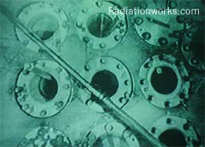
Courtesy RadiationWorks
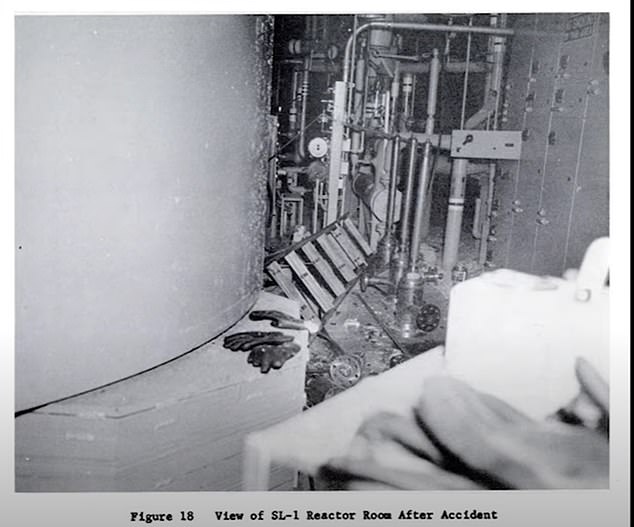
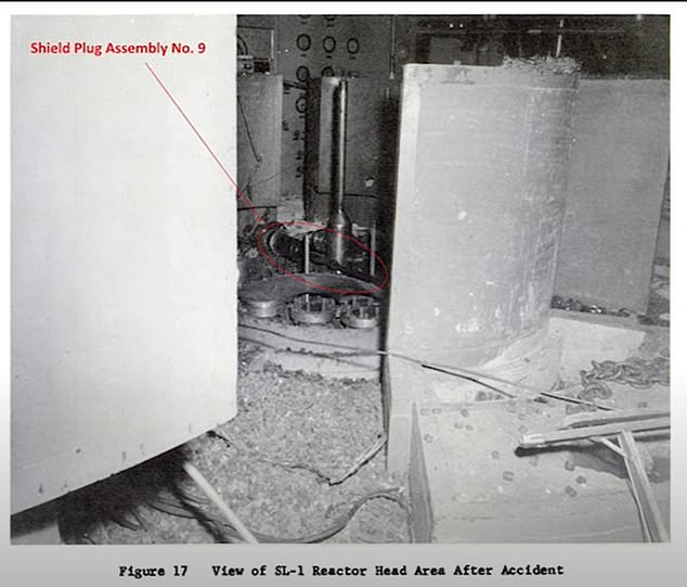

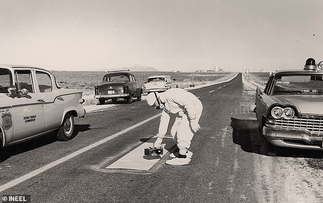
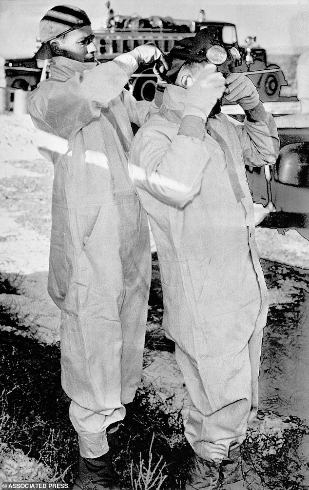
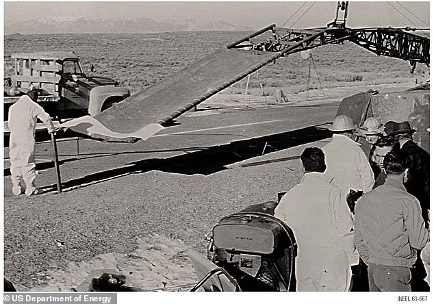
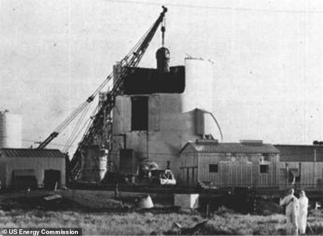
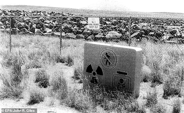
Nuclear Radiation Exposure and Contamination
Radiation Exposure Compensation Act
this is the entb
The Downwinders
Why are American taxpayers footing the bill for corporate pollution?
Why is the public always the unlucky casualty?
But vaccines cause Autism, right?
